| Engineer Terrain Intelligence Regiment SAEC | |
|---|---|
 | |
| Active | 2010 - present |
| Country |
|
| Allegiance |
|
| Branch | |
| Type | Military engineering |
| Role | Surveying, printed and digital cartography |
| Size | Regiment |
| Part of |
South African Army Engineer Formation Army Conventional |
| Garrison/HQ | Sappers Heights, Pretoria |
| Nickname(s) | ETIR |
| Motto(s) | Ubique |
| Colors | Guardsman Red and Oxford Blue[1] |
| Engagements | |
| Insignia | |
| Collar Badge | Bursting grenade with nine flames |
| Beret Colour | Oxford blue |
| Engineers Company Emblems |
 |
| Engineers Beret Bar circa 1992 |
 |
ETIR SAEC is a regiment of the South African Engineer Corps. The unit is based in Pretoria, Gauteng. The role of the Engineers is to maintain mobility and serviceability of own forces and counter mobility of enemy forces. Tasks include bridging, water purification, obstacles, demolition, infrastructure repair and development.
History
Engineer Terrain Intelligence Regiment is the amalgamation of 4 Survey and Mapping Regiment and 1 Military Printing Regiment.
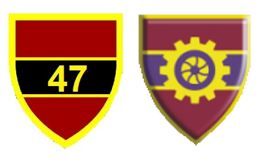
47 Survey Squadron
47 Survey Squadron was established in 1975 with a mandate to deliver mapping of foreign countries used by soldiers. 47 Survey Squadron produced the reproduction material used in the maps of foreign countries, the RSA border and military training areas.[2]
47 Survey Squadron was relocated from Germiston in 1994.
1 Military Printing Regiment
1 Military Printing Regiment was established in 1975 with a mandate to deliver mapping to soldiers. 1 Military Printing Regiment was responsible for the printing of the maps. 1 Military Printing Regiment was relocated from Koedoespoort in 1994.
Amalgamation
The new Terrain Intelligence Regiment is a combination of the these two units with a clear mandate to provide operational geographical support to clients within the DOD in the specific fields of mapping, surveying, navigation, terrain negotiability, printing and operational photography. The new Terrain Intelligence Regiment underwent changes in terms of technology, upgrading and this will enhance the service. The unit deploys internally and externally with the mobile operational geographic squadron that can provide the same capabilities as the static unit stationed in Pretoria.
References
- ↑ Englebrecht, Leon (9 February 2010). "Fact file: The SA Engineering Corps". DefenceWeb. http://www.defenceweb.co.za/index.php?option=com_content&view=article&id=6558:fact-file-the-sa-engineering-corps-&catid=79:fact-files&Itemid=159. Retrieved 20 October 2014.
- ↑ http://www.warinangola.com/Default.aspx?tabid=1239&ParameterString=South%20African%20Army&ParameterString2=Engineers
External Websites
| ||||||||||||||||||||||||||||||||||||||||||||||||||||||||||||||||||||||||||||||||||||||||||||||||||||||||||||||||||||||||||||||||||||||||||||||||
The original article can be found at Engineer Terrain Intelligence Unit and the edit history here.