| Bassein Fort | |
|---|---|
| Palghar district, Maharashtra | |
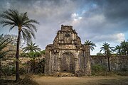
 The Fort's Facade | |
 <div style="position: absolute; top: Expression error: Missing operand for *.%; left: -805.4%; height: 0; width: 0; margin: 0; padding: 0;"> <div style="position: absolute; top: Expression error: Missing operand for *.%; left: -805.4%; height: 0; width: 0; margin: 0; padding: 0;">Bassein Fort | |
| Coordinates | 19°19′50.4″N 72°48′50.8″E / 19.330667°N 72.814111°E |
| Type | Sea side fort |
| Site information | |
| Owner | Government of India |
| Controlled by |
Chalukya dynasty ( -1432)
|
| Open to the public | Yes |
| Condition | Ruins |
| Site history | |
| Built | 1184 |
| Built by | Yadavas of Devgiri |
| Materials | Stone |
| Battles/wars | Battle of Bassein |
Fort Bassein/Vasai Fort/ Bacaim (Marathi language: वसई चा किल्ला) is a large fort in Vasai village, in the Vasai taluka (county) of the District of Palghar, Konkan Division, Maharashtra State, Republic of India. The name "Bassein" is the English version of the Portuguese "Baçaim" (with the "ç" spoken as "s" and with the "m" silent), itself a version of an apparently native name that may have a connection to the Vasa Konkani tribals of the North Konkan region, extending from Mumbai into "South Gujarat." The Marathi name of the place is Vasai.
The complete form of the Portuguese name is "Fortaleza de São Sebastião de Baçaim" or the Fort of St. Sebastian of Vasai. The Vasai fort is a monument of national importance and is protected by the Archaeological Survey of India.[1]
The fort and the village are accessible most easily through the Vasai Road Railway Station, which itself is in Manikpur-Navghar, a part of the newly raised City of Vasai-Virar, and lies to the immediate north of the cities of Mumbai and Mira Road-Bhayander. The "Vasai Road" Railway Station is on the Western Railway line (formerly the Mumbai, Baroda & Central India Railways) in the direction of Virar Railway Station.
History[]

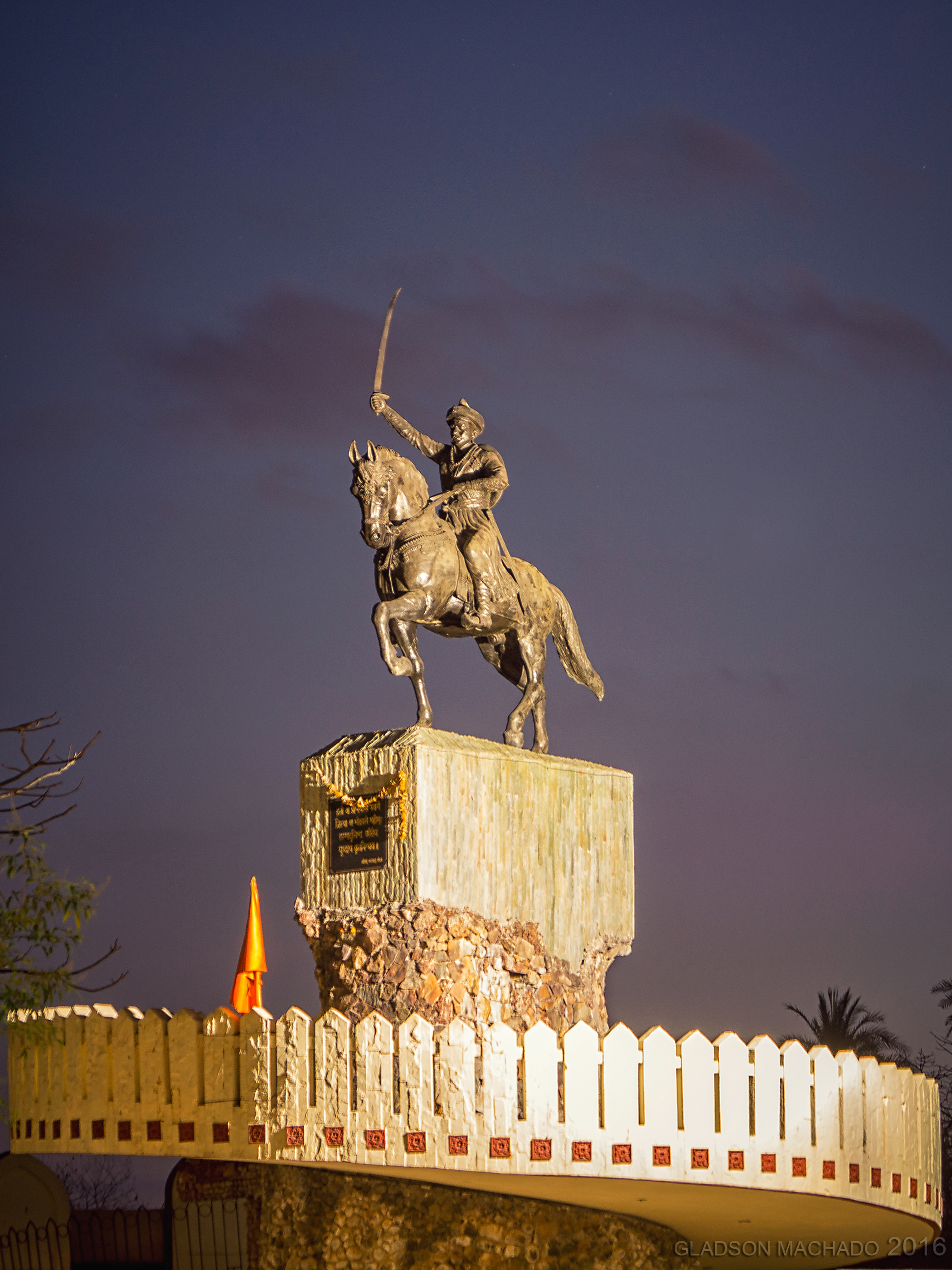
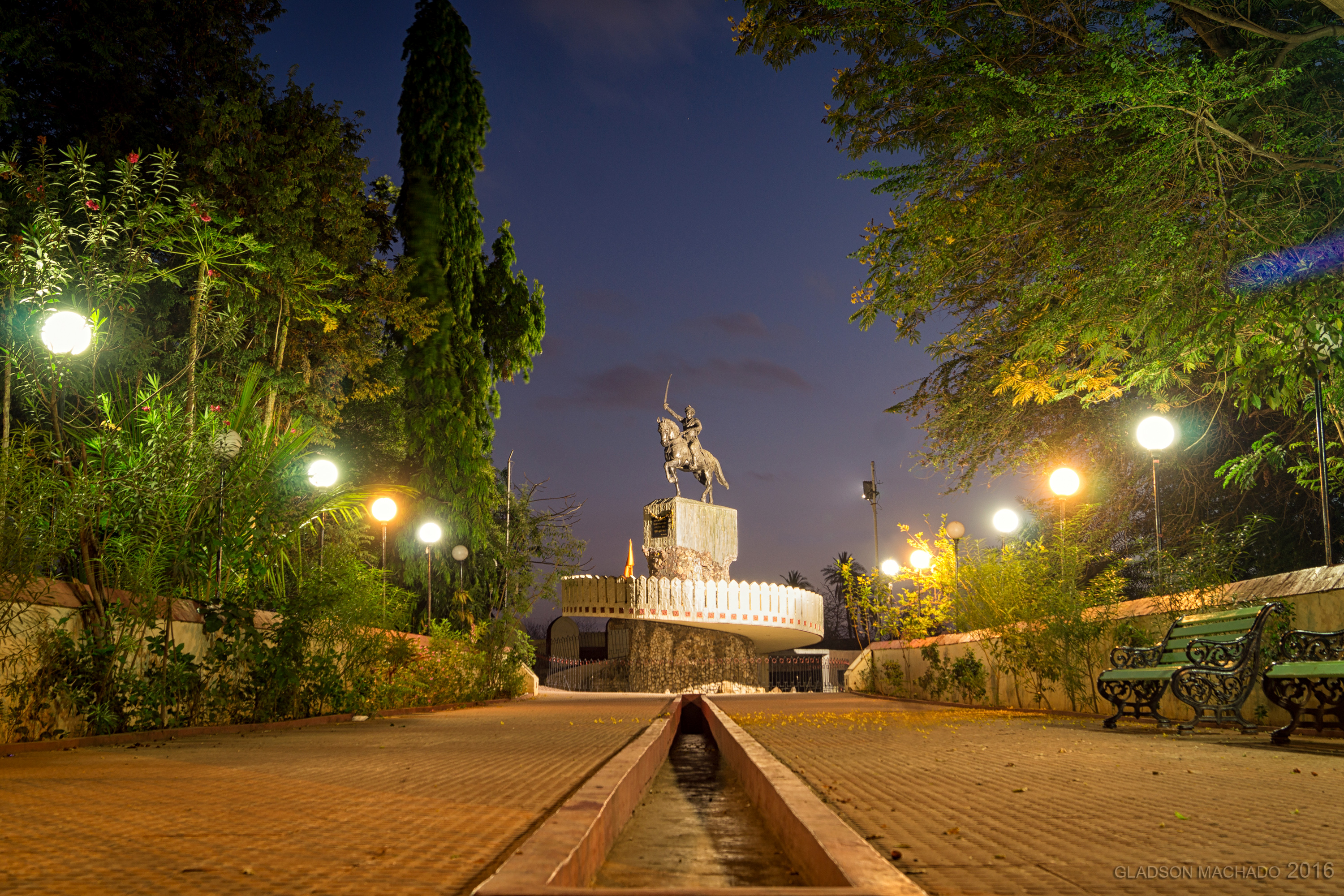
Statue of Chimaji Appa

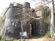
Main entrance to the Citadel
Pre Portuguese Era[]
The Greek merchant Cosma Indicopleustes is known to have visited the areas around Bassein in the 6th century, and the Chinese traveller Xuanzang later on June or July 640. According to Historian Joseph Gerson Da Cunha, during this time, Bassein and its surrounding areas appeared to have been ruled by the Chalukya dynasty of Karnataka.[2] Until the 11th century, several Arabian geographers had mentioned references to towns nearby Bassein, like Thana and Sopara, but no references had been made to Bassein.[3] Bassein was later ruled by the Silhara dynasty of Konkan, and eventually passed to the Yadavas of Devagiri. It was head of district under Yadavas (1184-1318). Later being conquered by the Gujarat Sultanate,[4] a few years later Barbosa (1514) described the city as Baxy as a town of Moors and Gentiles and a good sea port belonging to the king of Gujarat.[5]
Portuguese Era[]
The Portuguese first reached the west coast of India when the Portuguese explorer Vasco da Gama landed at Calicut in 1498.[5] For several years after their arrival in India, they had been consolidating their power in north Konkan.[6] They had established a strong foothold in Goa, which they captured from the Sultan of Bijapur in 1510.[7] According to Historian Faria y Souza, the coast of Bassein was first visited by the Portuguese in 1509, when Francisco de Almeida on his way to Diu captured a Muslim ship in the harbour of Bombay, with 24 citizens of Gujarat aboard.[8]


Panaoramic view from inside one of the buildings

Bassein Fort entrance
Portuguese mariners exploring the north Konkan Coast, discovered the Arab Sultanate of Khambat or Cambay, building or renovating or expanding the fort in the early 15th century and attacked it in a failed effort to seize it. Later, after more systematic efforts, the Sultanate of Cambay ceded the fort to Portugal by the Treaty of Saint Matthew signed on the Portuguese brig Sao Matteus anchored in the Bhayander Creek or Vasai Harbor.
The Treaty of Bassein was signed by Sultan Bahadur of Gujarat and the Kingdom of Portugal on 23 December 1534 while on board the galleon São Mateus. Based on the terms of the agreement, the Portuguese Empire gained control of the city of Bassein, as well as its territories, islands, and seas. The Mumbai Islands under Portuguese control include Colaba, Old Woman's Island, Mumbai, Mazagaon, Worli, Matunga, and Mahim. Salsette, Daman and Diu, Thane, Kalyan, and Chaul were other territories controlled and settled by the Portuguese.
At the time, the cession of Mumbai (or Bombay) was of minor importance - but retroactively it gained a crucial importance when the place passed from the Portuguese to the English in 1661 as part of the dowry of Catherine of Braganza, and became a major trade center - making this the treaty's most important long-range result. Bassein was the Portuguese northern capital from the time of their 16th century treaty with the Sultan. Under Portugal, the fort was the Northern Court or "Corte da Norte," second only to the City of Goa, functioning as the headquarters of the Captain of the North. For 150 odd years, the presence of the Portuguese made the surrounding area a vibrant and opulent city.[6] As such it was the capital of Portuguese possessions on the coast north of Goa, over places such as Chaul-Revdanda, Karanja Island, the Bombay Archipelago, Bandra Island, Juhu Island, Salsette Island including the City of Thane, Dharavi Island, the Vasai archipelago itself, Daman, Diu, and other Portuguese holdings extending up the coasts to Pakistan, Oman, the UAE, Iran, and other parts of the Persian Gulf.
The ethnic community locally known in the Bombay region as the "East Indians" (sic) were called "Norteiro" (Northernmen) after the Court of the North functioning out of the fort.

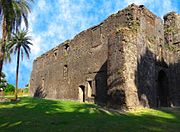
One of the few standing structures


Maratha Era[]
In the 18th century, the fort was taken over by the Maratha army under Peshwa Baji Rao's brother Chimaji Appa, and fell in 1739 after a three-year-long campaign. (See-Battle of Vasai). The fort was taken by British in 1774 and returned back to Maratha in 1783 under the Treaty of Salbai. The British in 1818 attacked and took over the territory from the Marathas as the price for supporting one faction of the Marathas against another.The fort also played a strategic role in the First Anglo-Maratha War.[7]
Present[]
The ramparts overlook what is alternatively called the Vasai Creek and the Bhayander Creek and are almost complete, though overgrown by vegetation. Several watch-towers still stand, with safe staircases leading up. The Portuguese buildings inside the fort are in ruins, although there are enough standing walls to give a good idea of the floor plans of these structures. Some have well-preserved façades. In particular, many of the arches have weathered the years remarkably well. They are usually decorated with carved stones, some weathered beyond recognition, others still displaying sharp chisel marks.
Three chapels inside the fort are still recognizable. They have façades typical of 17th-century Portuguese churches. The southernmost of these has a well-preserved barrel-vaulted ceiling.
The fort is often used for shooting Bollywood film scenes. The films shot here include Josh, Khamoshi, and Ram Gopal Verma's Aag.
Besides all the structures one should not miss observing the nature that has taken over much of the fort. It is a great place to observe butterflies, birds, plants and reptiles.
The Archaeological Survey of India has started restoration work of the fort, although the quality of the work has been severely criticized by "conservation activists". It is best weekend destination for the tourist, photographers and nature enthusiast.

Chimaji Appa Memorial
Accessibility[]
One needs to take a Western Railways train bound to Virar from Churchgate and get off at Vasai Road. If someone is coming from the Central Railway or Central Railway Harbour Line then they have to switch to the Western Railway line at either Dadar, Bandra or Andheri. Another railway line connects the Central and the Western Railways lines from Vasai Road Railway Station to Diva, a stop just beyond Thane city on the Central Railway line, and long-distance passenger trains travelling this route also carry commuters between the two lines. A new railway station named Kopar has started which is between Diva and Dombivli. Passengers travelling from Thane or Kalyan can alight at Kopar and go top by staircase and at Platform No.3 they can catch the Diva to Vasai train. Vasai Road station is only one hour by train from Kopar station. Currently there are 5 trains daily which goes to Vasai Road from Dombivli, Diva and Panvel and 5 trains from Vasai Road to Diva and Panvel. There is a State Road Transport Bus Terminus & Station adjacent and to the immediate west of the Vasai Road Railway Station in Manickpur-Navghar. The destination for buses going to the Vasai fort is "Killa Bunder" or "Fort Jetty/Quay." There are buses every half-hour. Ticket costs you Rs. 7.00 and you can get off at the last stop and walk around. Auto-Rickshaws are also available which can be hired from the western entrance to the Railway station but cost more per head and are unsafe in that they are usually congested. Auto Rickshaws are also available which can be hired from the main road outside the station but it would cost you around Rs.20.00 per head.[8]
Gallery[]
The Flora and Fauna inside the fort premises.
")
")
")
")
")
")
")
")
See also[]
- List of treaties
- Military history of Bassein
- List of forts in Maharashtra
- List of forts in India
- Chimaji Appa
- Maratha Navy
- List of Maratha dynasties and states
- Battles involving the Maratha Empire
- Maratha Army
- Military history of India
- Military history of Bassein
References[]
- ↑ Monument #110, Mumbai Circle, ASI: http://asi.nic.in/asi_monu_alphalist_maharashtra_mumbai.asp
- ↑ Da Cunha 1999, p. 129
- ↑ Da Cunha 1999, p. 130
- ↑ Da Cunha 1999, p. 131
- ↑ https://cultural.maharashtra.gov.in/english/gazetteer/Thane/places_b.html
- ↑ Maharashtra Tourism: Vasai Fort - http://www.maharashtratourism.gov.in/MTDC/HTML/MaharashtraTourism/TouristDelight/Forts/Forts.aspx?strpage=VasaiFort.html
- ↑ Naravane, M.S. (2014). Battles of the Honorourable East India Company. A.P.H. Publishing Corporation. pp. 60. ISBN 9788131300343.
- ↑ Time To Travel: Vasai Fort - http://www.timetotravel.co.in/2010/01/vasai-fort.html
Bibliography[]
- Rossa, Walter (2012). "Vasai Fort: Historical Background and Urbanism". Heritage of Portuguese Influence. http://www.hpip.org/def/en/Contents/Navigation/GeographicToponymicNavigation/Place?a=567. Retrieved 29 July 2015.
- Mendiratta, Sidh Losa (2012). "St. Sebastian Fort: Military Architecture". Heritage of Portuguese Influence. http://www.hpip.org/Default/en/Homepage/Entry?a=323. Retrieved 29 July 2015.
- Mendiratta, Sidh Losa (2012). "Dispositivos do Sistema Defensivo da Província do Norte do Estado da Índia (1521-1739)". PhD Thesis, Coimbra University. https://www.academia.edu/8707147/DISPOSITIVOS_DO_SISTEMA_DEFENSIVO_DA_PROV%C3%8DNCIA_DO_NORTE_DO_ESTADO_DA_%C3%8DNDIA_1521-1739.
External links[]
| |||||
| ||||||||||||||||||||||||||||||||||||||||||||||||||||||||
| ||||||||||||||||||||||||||||||||||||||||||||||||||||||||||||||
Coordinates: 19°19′49″N 72°48′54″E / 19.33028°N 72.815°E
The original article can be found at Fort Bassein and the edit history here.