GLONASS logo
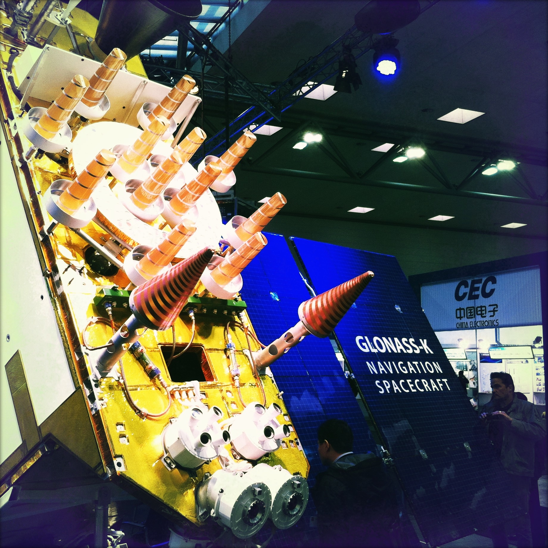
A model of a GLONASS-K satellite displayed at CeBit 2011
GLONASS (Russian: ГЛОНАСС, IPA: [ɡlɐˈnas]; Глобальная навигационная спутниковая система), acronym for Globalnaya navigatsionnaya sputnikovaya sistema or Global Navigation Satellite System, is a space-based satellite navigation system operated by the Russian Aerospace Defence Forces. It provides an alternative to Global Positioning System (GPS) and is the only alternative navigational system in operation with global coverage and of comparable precision.
Development of GLONASS began in the Soviet Union in 1976. Beginning on 12 October 1982, numerous rocket launches added satellites to the system until the constellation was completed in 1995. During the 2000s, under Vladimir Putin's presidency, the restoration of the system was made a top government priority and funding was substantially increased. GLONASS is the most expensive program of the Russian Federal Space Agency, consuming a third of its budget in 2010.
By 2010, GLONASS had achieved 100% coverage of Russia's territory and in October 2011, the full orbital constellation of 24 satellites was restored, enabling full global coverage. The GLONASS satellites' designs have undergone several upgrades, with the latest version being GLONASS-K.
History[]
Inception and design[]

A GLONASS satellite
The first satellite-based radio navigation system developed in the Soviet Union was Tsiklon, which had the purpose of providing ballistic missile submarines a method for accurate positioning. 31 Tsiklon satellites were launched between 1967 and 1978. The main problem with the system was that, although highly accurate for stationary or slow-moving ships, it required several hours of observation by the receiving station to fix a position, making it unusable for many navigation purposes and for the guidance of the new generation of ballistic missiles.[1] In 1968–1969, a new navigation system, which would support not only the navy, but also the air, land and space forces, was conceived. Formal requirements were completed in 1970; in 1976, the government made a decision to launch development of the "Unified Space Navigation System GLONASS".[2]
The task of designing GLONASS was given to a group of young specialists at NPO PM in the city of Krasnoyarsk-26 (today called Zheleznogorsk). Under the leadership of Vladimir Cheremisin, they developed different proposals, from which the institute's director Grigory Chernyavsky selected the final one. The work was completed in the late 1970s; the system would consist of 24 satellites operating at an altitude of 20,000 km in medium circular orbit. It would be able to promptly fix the receiving station's position based on signals from 4 satellites, and also reveal the object's speed and direction. The satellites would be launched 3 at a time on the heavy-lift Proton rocket. Due to the large number of satellites needed for the program, NPO PM delegated the manufacturing of the satellites to PO Polyot in Omsk, which had better production capabilities.[3][4]
Originally, GLONASS was designed to have an accuracy of 65 m, but in reality it had an accuracy of 20 m in the civilian signal and 10 m in the military signal.[5] The first generation GLONASS satellites were 7.8 m tall, had a width of 7.2 m, measured across their solar panels, and a mass of 1,260 kg.[5]
Achieving full orbital constellation[]
In the early 1980s, NPO PM received the first prototype satellites from PO Polyot for ground tests. Many of the produced parts were of low quality and NPO PM engineers had to perform substantial redesigning, leading to a delay.[3] On 12 October 1982, three satellites, designated Kosmos-1413, Kosmos-1414, and Kosmos-1415 were launched aboard a Proton rocket. As only one GLONASS satellite was ready in time for the launch instead of the expected three, it was decided to launch it along with two mock-ups. The American media reported the event as a launch of one satellite and "two secret objects." For a long time, the Americans could not find out the nature of those "objects". The Telegraph Agency of the Soviet Union (TASS) covered the launch, describing GLONASS as a system "created to determine positioning of civil aviation aircraft, navy transport and fishing-boats of the Soviet Union".[3]
From 1982 through April 1991, the Soviet Union successfully launched a total of 43 GLONASS-related satellites plus five test satellites. When the Soviet Union disintegrated in 1991, twelve functional GLONASS satellites in two planes were operational; enough to allow limited usage of the system (to cover the entire territory of the country, 18 satellites would have been necessary.) The Russian Federation took over control of the constellation and continued its development.[4] In 1993, the system, now consisting of 12 satellites, was formally declared operational[6] and in December 1995, the constellation was finally brought to its optimal status of 24 operational satellites. This brought the precision of GLONASS on-par with the American GPS system, which had achieved full operational capability а year earlier.[4]
Economic crisis and fall into disrepair[]
Since the first generation satellites operated for 3 years each, to keep the system at full capacity, two launches per year would have been necessary to maintain the full network of 24 satellites. However, in the financially difficult period of 1989–1999, the space program's funding was cut by 80% and Russia consequently found itself unable to afford this launch rate. After the full complement was achieved in December 1995, there were no further launches until December 1999. As a result, the constellation reached its lowest point of just 6 operational satellites in 2001. As a prelude to demilitarisation, responsibility of the program was transferred from the Ministry of Defence to Russia's civilian space agency Roscosmos.[5]
Renewed efforts and modernization[]
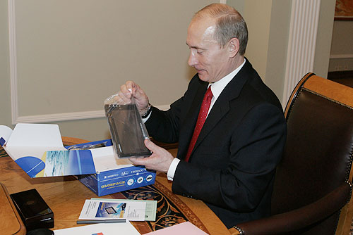
President Vladimir Putin with a GLONASS car navigation device. As President, Putin paid special attention to the development of GLONASS.
In the 2000s, under Vladimir Putin's presidency, the Russian economy recovered and state finances improved considerably. Putin himself took special interest in GLONASS[5] and the system's restoration was made one of the government's top priorities.[7] For this purpose, on August 2001, the Federal Targeted Program "Global Navigation System" 2002–2011 (Government Decision No. 587) was launched. The program was given a budget of $420 million[8] and aimed at restoring the full constellation by 2009.
On 10 December 2003, the second generation satellite design, GLONASS-M, was launched for the first time. It had a slightly larger mass than the baseline GLONASS, standing at 1,415 kg, but it had double the original's lifetime, decreasing the required replacement rate by 50%. The new satellite also had better accuracy and ability to broadcast two extra civilian signals.
In 2006, Defence Minister Sergey Ivanov ordered one of the signals (with an accuracy of 30 m) to be made available to civilian users. Putin, however, was not satisfied with this, and demanded that the whole system should be made fully available to everyone. Consequently, on 18 May 2007, all restrictions were lifted.[6][9] The accurate, formerly military-only signal with a precision of 10 m, has since then been freely available to civilian users.
During the middle of the first decade of 21st century, the Russian economy boomed, resulting in substantial increases in the country's space budget. In 2007, the financing of the GLONASS program was increased considerably; its budget was more than doubled. While in 2006 the GLONASS had received $181 million from the federal budget, in 2007 the amount was increased to $380 million.[6]
In the end, 140.1 billion rubles ($4.7 billion) were spent on the program 2001–2011, making it Roscosmos' largest project and consuming a third of its 2010 budget of 84.5 billion rubles.[10]
From 2012 to 2020 on GLONASS from Russian budget allocated 320 billion rubles (10 billion USD).[11]
Restoring full capacity[]
In June 2008, the system consisted of 16 satellites, 12 of which were fully operational at the time. At this point, Roscosmos aimed at having a full constellation of 24 satellites in orbit by 2010, one year later than previously planned.[12]
In September 2008, Prime Minister Vladimir Putin signed a decree allocating additional 67 billion rubles (2.6 billion USD) to GLONASS from the federal budget.[13]
Promoting commercial use[]


Yo-mobil is planned to be equipped with GLONASS/GPS navigation device

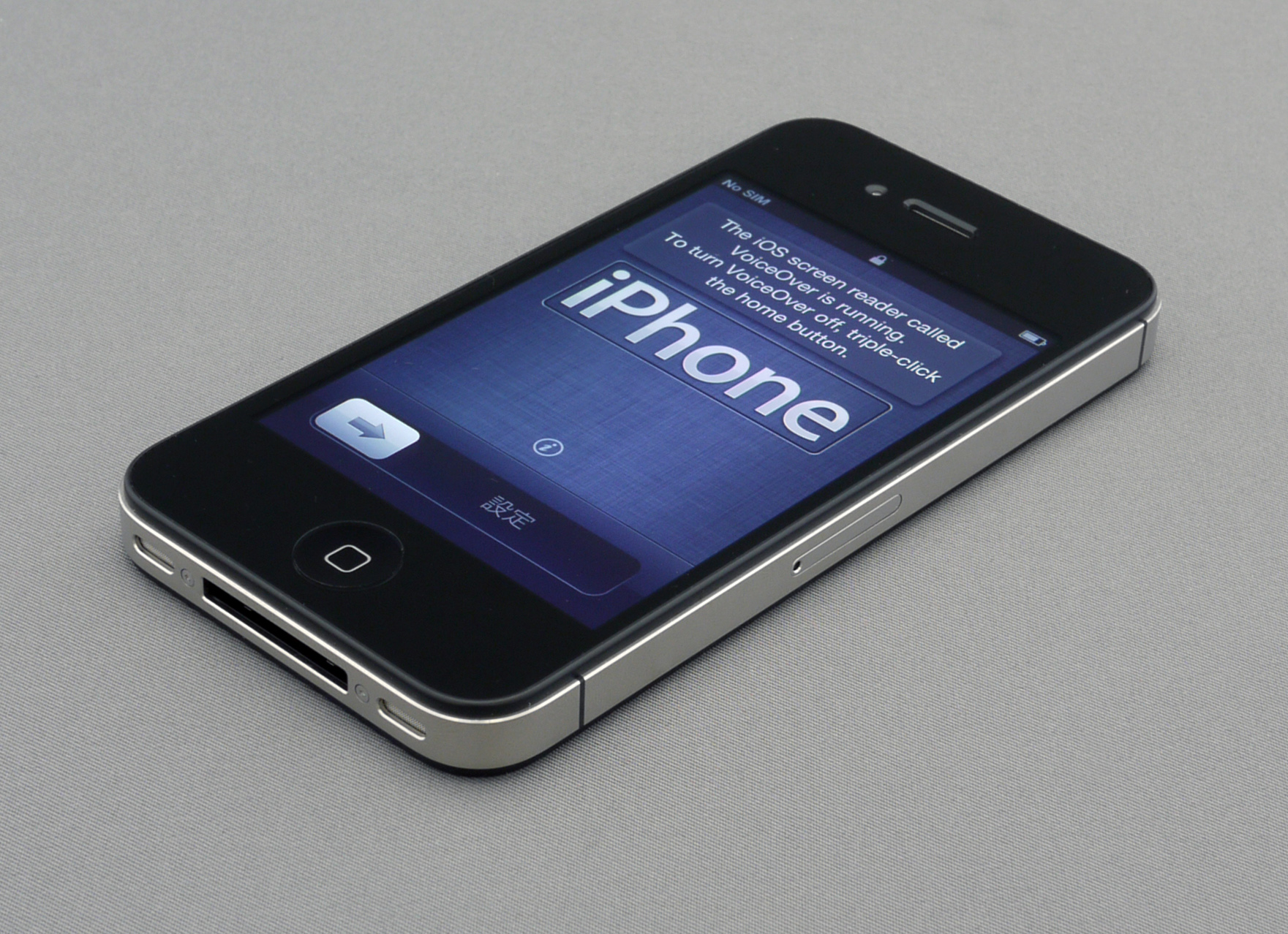
The iPhone 4S was the first Apple product using both GPS and GLONASS navigation.
Although the GLONASS constellation has reached global coverage, its commercialisation, especially development of the user segment, has been lacking compared to the American GPS system. For example, the first commercial Russian-made GLONASS navigation device for cars, Glospace SGK-70, was introduced in 2007, but it was much bigger and more costly than similar GPS receivers.[7] In late 2010, there were only a handful of GLONASS receivers on the market, and few of them were meant for ordinary consumers. To improve the situation, the Russian government has been actively promoting GLONASS for civilian use.[14]
To improve development of the user segment, on August 11, 2010, Sergei Ivanov announced a plan to introduce a 25% import duty on all GPS-capable devices, including mobile phones, unless they are compatible with GLONASS. As well, the government is planning to force all car manufacturers in Russia to make cars with GLONASS starting from 2011. This will affect all car makers, including foreign brands like Ford and Toyota, which have car assembly facilities in Russia.[15]
GPS and phone baseband chips from major vendors ST-Ericsson,[16] Broadcom[17] and Qualcomm all support GLONASS in combination with GPS. In April 2011, Sweden's Swepos, a national network of satellite reference stations which provides data for real-time positioning with meter accuracy, became the first known foreign company to use GLONASS.[18]
Smartphones and Tablets also saw implementation of GLONASS support in 2011 with devices released that year from Xiaomi Tech Company (Xiaomi Phone 2), Sony Ericsson, Samsung (the Google Nexus 10 in late 2012), Asus, Apple (iPhone 4S and iPad Mini in late 2012) and HTC adding support for the system allowing increased accuracy and lock on speed in difficult conditions.[19][20][21]
Finishing the constellation[]
Russia's aim of finishing the constellation in 2010 suffered a setback when a December 2010 launch of three GLONASS-M satellites failed. The Proton-M rocket itself performed flawlessly, but the upper stage Blok DM3 (a new version which was to make its maiden flight) was loaded with too much fuel due to a sensor failure. As a result, the upper stage and the three satellites crashed into the Pacific Ocean. Kommersant estimated that the launch failure cost up to $160 million.[22] Russian President Dmitry Medvedev ordered a full audit of the entire program and an investigation into the failure.[23]
Following the mishap, Roscosmos activated two reserve satellites and decided to make the first improved GLONASS-K satellite, to be launched in February 2011, part of the operational constellation instead of mainly for testing as was originally planned. This would bring the total number of satellites to 23, obtaining almost complete worldwide coverage.[24] The GLONASS-K2 was originally scheduled to be launched by 2013, however by 2012 was not expected to be launched until 2015.[25] In 2010, President Dmitry Medvedev ordered the government to prepare a new federal targeted program for GLONASS, covering the years 2012–2020. The original 2001 program is scheduled to end in 2011.[22] On 22 June 2011, Roscosmos revealed that the agency was looking for a funding of 402 billion rubles ($14.35 billion) for the program. The funds would be spent on maintaining the satellite constellation, on developing and maintaining navigational maps as well as on sponsoring supplemental technologies to make GLONASS more attractive to users.[26]
On 2 October 2011 the 24th satellite of the system, a GLONASS-M, was successfully launched from Plesetsk Cosmodrome and is now in service.[27] This made the GLONASS constellation fully restored, for the first time since 1996.[28]
On 5 November 2011 the Proton-M booster successfully put three GLONASS-M units in final orbit.[29]
On Monday 28 November 2011, a Soyuz rocket, launched from the Plesetsk Cosmodrome Space Centre, placed a single GLONASS-M satellite into orbit into Plane 3.
On 26 April 2013 a single GLONASS-M satellite was delivered to the orbit by Soyuz rocket from Plesetsk Cosmodrome, restoring the constellation to 24 operational satellites, the minimum to provide global coverage.[30]
On 2 July 2013 a Proton-M rocket, carrying 3 GLONASS-M satellites, crashed during takeoff from Baikonur Cosmodrome. It veered off the course just after leaving the pad and plunged into the ground nose first. The rocket employed a DM-03 booster, for the first time since the December 2010 launch, when the vehicle had also failed, resulting in a loss of another 3 satellites.[31]
System description[]
GLONASS is a global satellite navigation system, providing real time position and velocity determination for military and civilian users. The satellites are located in middle circular orbit at 19,100 km altitude with a 64.8 degree inclination and a period of 11 hours and 15 minutes.[32][33] GLONASS' orbit makes it especially suited for usage in high latitudes (north or south), where getting a GPS signal can be problematic.[5][7] The constellation operates in three orbital planes, with 8 evenly spaced satellites on each.[33] A fully operational constellation with global coverage consists of 24 satellites, while 18 satellites are necessary for covering the territory of Russia. To get a position fix the receiver must be in the range of at least four satellites.[32]
FDMA signals[]
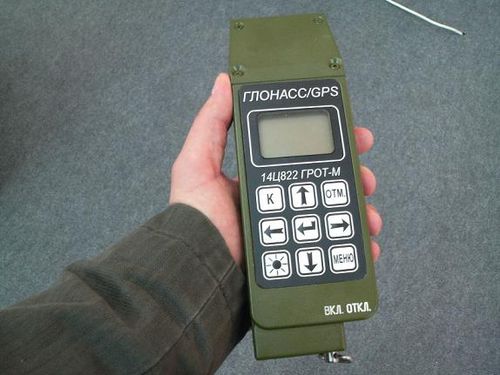

A Russian military rugged, combined GLONASS/GPS receiver
GLONASS satellites transmit two types of signal: a standard precision (SP) signal and an obfuscated high precision (HP) signal.
The signals use similar DSSS encoding and binary phase-shift keying (BPSK) modulation as in GPS signals. All GLONASS satellites transmit the same code as their SP signal; however each transmits on a different frequency using a 15-channel frequency division multiple access (FDMA) technique spanning either side from 1602.0 MHz, known as the L1 band. The center frequency is 1602 MHz + n × 0.5625 MHz, where n is a satellite's frequency channel number (n=−7,−6,−5,...0,...,6, previously n=0,...,13). Signals are transmitted in a 38° cone, using right-hand circular polarization, at an EIRP between 25 to 27 dBW (316 to 500 watts). Note that the 24-satellite constellation is accommodated with only 15 channels by using identical frequency channels to support antipodal (opposite side of planet in orbit) satellite pairs, as these satellites will never be in view of an earth-based user at the same time. The L2 signals use the same FDMA as the L1 band signals, but transmit straddling 1246 MHz with the center frequency determined by the[Clarification needed] equation 1246 MHz + n×0.4375 MHz, where n spans the same range as for L1.[34] Other details of the HP signal have not been disclosed.
A combined GLONASS/GPS Personal Radio Beacon
At peak efficiency, the SP signal offers horizontal positioning accuracy within 5–10 meters, vertical positioning within 15 meters, a velocity vector measuring within 10 cm/s, and timing within 200 ns, all based on measurements from four first-generation satellites simultaneously;[35] newer satellites such as GLONASS-M improve on this. Starting with Glonass-M, an additional civil reference signal is broadcast in the L2 band with an identical SP code to the L1 band signal. This is available from all satellites in the constellation, except satellite number 795 which is the last of the inferior original GLONASS design, and one partially inoperable GLONASS-M satellite which is broadcasting only in the L1 band. (See www.glonass-ianc.rsa.ru for daily updates on constellation status.)
GLONASS uses a coordinate datum named "PZ-90" (Earth Parameters 1990 – Parametry Zemli 1990), in which the precise location of the North Pole is given as an average of its position from 1900 to 1905. This is in contrast to the GPS's coordinate datum, WGS 84, which uses the location of the North Pole in 1984. As of September 17, 2007 the PZ-90 datum has been updated to version PZ-90.02 which differ from WGS 84 by less than 40 cm (16 in) in any given direction.
The open SP signal is generated with modulo-2 addition (XOR) of 511 kbit/s pseudo-random ranging code, 50 bit/s navigation message, and an auxiliary 100 Hz meander sequence (Manchester code), all generated using a single time/frequency oscillator. The pseudo-random code is generated with a 9-stage shift register operating with a period of 1 ms.
The navigational message is modulated at 50 bits per second. The superframe of the open signal is 7500 bits long and consits of 5 frames of 30 seconds, taking 150 seconds (2.5 minutes) to transmit the continuous message. Each frame is 1500 bits long and consists of 15 strings of 100 bits (2 seconds for each string), with 85 bits (1.7 seconds) for data and check-sum bits, and 15 bits (0.3 seconds) for time mark. Strings 1-4 provide immediate data for the transmitting satellite, and are repeated every frame; the data include ephemeris, clock and frequency offsets, and satellite status. Strings 5-15 provide non-immediate data (i.e. almanac) for each satellite in the constellation, with frames I-IV each describing 5 satellites, and frame V describing remaining 4 satellites. The ephemerides are updated every 30 minutes using data from the Ground Control segment; they use Earth Centred Earth Fixed (ECEF) Cartesian coordinates in position and velocity, and include lunisolar acceleration parameters. The almanac uses modified Keplerian parameters and is updated daily.
The more accurate HP signal is available for authorized users, such as the Russian Military, yet unlike the US P(Y) code which is modulated by an encrypting W code, the GLONASS P codes are broadcast in the clear using only 'security through obscurity'. Use of this signal bears risk however as the modulation (and therefore the tracking strategy) of the data bits on the L2P code has recently changed from unmodulated to 250 bit/s burst at random intervals. The L1P code is modulated at 50 bit/s without a Manchester meander code.
The HP signal is broadcast in phase quadrature with the SP signal, effectively sharing the same carrier wave as the SP signal, but with a ten-times-higher bandwidth than the SP signal. The message format of the high precision signal remains unpublished, although attempts at reverse-engineering indicate that the superframe is composed of 72 frames, each containing 5 strings of 100 bits and taking 10 seconds to transmit, with total length of 36 000 bits or 720 seconds (12 minutes) for the whole navigational message. The additional data are seemingly allocated to critical Luni-Solar acceleration parameters and clock correction terms.
CDMA signals[]
Since 2008, new CDMA signals are being researched for use with GLONASS.[36][37][38][39][40][41][42]
According to preliminary statements from GLONASS developers, there will be three open and two restricted CDMA signals. The open signal L3OC is centered at 1202.25 MHz and uses BPSK(10) modulation for both data and pilot channels; the ranging code transmits at 10.23 million chips per second, modulated onto the carrier frequency using QPSK with in-phase data and quadrature pilot. The data is error-coded with 5-bit Barker code and the pilot with 10-bit Neuman-Hoffman code.
Open L1OC and restricted L1SC signals are centered at 1600.995 MHz, and open L2OC and restricted L2SC signals are centered at 1248.06 MHz, overlapping with GLONASS FDMA signals. Open signals L1OC and L2OC use time-division multiplexing to transmit pilot and data signals, with BPSK(1) modulation for data and BOC(1,1) modulation for pilot; wide-band restricted signals L1SC and L2SC use BOC(5, 2.5) modulation for both data and pilot, transmitted in quadrature phase to the open signals; this places peak signal strength away from the center frequency of narrow-band open signals.[42][43]
Binary phase-shift keying (BPSK) is used by standard GPS and GLONASS signals, however both BPSK and quadrature phase-shift keying (QPSK) can be considered as variations of quadrature amplitude modulation (QAM), specifically QAM-2 and QAM-4. Binary offset carrier (BOC) is the modulation used by Galileo, modernized GPS, and COMPASS.
The navigational message of the L3OC signal is transmitted at 100 bit/s. The navigational frame is 15 seconds (1500 bits) long and includes 5 strings of symbols each taking 3 seconds (300 bits); a frame contains ephemerides for the current satellite and part of the almanac for three satellites. The superframe consists of 8 navigational frames, so it takes 120 seconds (2 minutes) to transmit 12000 bits of almanac for all current 24 satellites; in the future, the superframe will be expanded to 10 frames or 15000 bits (150 seconds or 2.5 minutes) of data to cover full 30 satellites. The system time marker is transmitted with each string; UTC leap second correction is achieved by shortening or lengthening (zero-padding) the final string of the day by one second (100 bits), with shortened strings being discarded by the receiver.[44]
| Satellite series | Launch | Current status | Clock error | FDMA signals | CDMA signals | Interoperability CDMA signals | |||||
|---|---|---|---|---|---|---|---|---|---|---|---|
| 1602 + n×0.5625 MHz | 1246 + n×0.4375 MHz | 1600.995 MHz | 1248.06 MHz | 1202.25 MHz | 1575.42 MHz | 1207.14 MHz | 1176.45 MHz | ||||
| GLONASS | 1982-2005 | Out of service | 5×10⁻¹³ | L1OF, L1SF | L2SF | ||||||
| GLONASS-M | 2003-2016 | In service | 1×10⁻¹³ | L1OF, L1SF | L2OF, L2SF | L3OС ‡ | |||||
| GLONASS-K1 | 2011, 2013 | In service | 5×10⁻¹⁴...1×10−13 | L1OF, L1SF | L2OF, L2SF | L3OС | |||||
| GLONASS-K2 | 2015-2024 | Design phase | 5×10⁻¹⁴ | L1OF, L1SF | L2OF, L2SF | L1OC, L1SC | L2OC, L2SC | L3OC | |||
| GLONASS-KМ | 2025- | Research phase | L1OF, L1SF | L2OF, L2SF | L1OC, L1SC | L2OC, L2SC | L3OC, L3SC | L1OCM | L3OCM | L5OCM | |
| "O": open signal (standard precision), "S": obfuscated signal (high precision); "F":FDMA, "С":CDMA; n=−7,−6,−5,...,6 ‡Glonass-M series will include L3OC signal from 2014 | |||||||||||
Glonass-K1 test satellite launched in 2011 introduced L3OC signal. The final Glonass-M satellites launched in 2014-2017 will also include L3OC signal. Glonass-K2 satellites, to be launched in 2015, will feature a full suite of modernized CDMA signals in the existing L1 and L2 bands, which includes L1SC, L1OC, L2SC, and L2OC, as well as the L3OC signal. Glonass-K2 should gradually replace existing satellites starting from 2017, when Glonass-M launches will cease.
Glonass-KM satellites will be launched by 2025. Additional open signals are being studied for these satellites, based on the same frequencies and formats as GPS signals L5 and L1C and corresponding Galileo/COMPASS signals E1, E5a and E5b. These signals include:
- The open signal L1OCM will use BOC(1,1) modulation centered at 1575.42 MHz, similar to modernized GPS signal L1C and Galileo/COMPASS signal E1;
- The open signal L5OCM will use BPSK(10) modulation centered at 1176.45 MHz, similar to the GPS "Safety of Life" (L5) and Galileo/COMPASS signal E5a;[45]
- The open signal L3OCM will use BPSK(10) modulation centered at 1207.14 MHz, similar to Galileo/COMPASS signal E5b.[38]
Such an arrangement will allow easier and cheaper implementation of multi-standard GNSS receivers.
With the introduction of CDMA signals, the constellation will be expanded to 30 active satellites by 2025; this may require eventual deprecation of FDMA signals.[46] The new satellites will be deployed into three additional planes, bringing the total to six planes from the current three, aided by System for Differential Correction and Monitoring (SDCM) which is a GNSS augmentation system based on a network of ground-based control stations and communication satellites Luch 5A and Luch 5B.[47][48] Additional satellites may use Molniya orbit, Tundra orbit, geosynchronous orbit, or inclined orbit to offer increased regional availability, similar to Japanese QZSS system.[38][44]
Satellites[]
The main contractor of the GLONASS program is Joint Stock Company Reshetnev Information Satellite Systems (formerly called NPO-PM). The company, located in Zheleznogorsk, is the designer of all GLONASS satellites, in cooperation with the Institute for Space Device Engineering (ru:РНИИ КП) and the Russian Institute of Radio Navigation and Time. Serial production of the satellites is accomplished by the company PC Polyot in Omsk.
Over the three decades of development, the satellite designs have gone through numerous improvements, and can be divided into three generations: the original GLONASS (since 1982), GLONASS-M (since 2003) and GLONASS-K (since 2011). Each GLONASS satellite has a GRAU designation 11F654, and each of them also has the military "Cosmos-NNNN" designation.[49]
First generation[]
The true first generation of GLONASS (also called Uragan) satellites were all 3-axis stabilized vehicles, generally weighing 1,250 kg and were equipped with a modest propulsion system to permit relocation within the constellation. Over time they were upgraded to Block IIa, IIb, and IIv vehicles, with each block containing evolutionary improvements.
Six Block IIa satellites were launched in 1985–1986 with improved time and frequency standards over the prototypes, and increased frequency stability. These spacecraft also demonstrated a 16-month average operational lifetime. Block IIb spacecraft, with a 2-year design lifetimes, appeared in 1987, of which a total of 12 were launched, but half were lost in launch vehicle accidents. The six spacecraft that made it to orbit worked well, operating for an average of nearly 22 months.
Block IIv was the most prolific of the first generation. Used exclusively from 1988 to 2000, and continued to be included in launches through 2005, a total of 25 satellites were launched. The design life was three years, however numerous spacecraft exceeded this, with one late model lasting 68 months.[50]
Block II satellites were typically launched three at a time from the Baikonur Cosmodrome using Proton-K Blok-DM-2 or Proton-K Briz-M boosters. The only exception was when, on two launches, an Etalon geodetic reflector satellite was substituted for a GLONASS satellite.
Second generation[]
The second generation of satellites, known as Glonass-M, were developed beginning in 1990 and first launched in 2003. These satellites possess a substantially increased lifetime of seven years and weigh slightly more at 1,480 kg. They are approximately 2.4 m (7 ft 10 in) in diameter and 3.7 m (12 ft) high, with a solar array span of 7.2 m (24 ft) for an electrical power generation capability of 1600 watts at launch. The aft payload structure houses 12 primary antennas for L-band transmissions. Laser corner-cube reflectors are also carried to aid in precise orbit determination and geodetic research. On-board cesium clocks provide the local clock source.
A total of fourteen second generation satellites were launched through the end of 2007. As with the previous generation, the second generation spacecraft were launched in triplets using Proton-K Blok-DM-2 or Proton-K Briz-M boosters.
Third generation[]


A GLONASS-K satellite model displayed at CeBIT 2011
GLONASS-K is a substantial improvement of the previous generation: it is the first unpressurised GLONASS satellite with a much reduced mass (750 kg versus 1,450 kg of GLONASS-M). It has an operational lifetime of 10 years, compared to the 7-year lifetime of the second generation GLONASS-M. It will transmit more navigation signals to improve the system's accuracy, including new CDMA signals in the L3 and L5 bands which will use modulation similar to modernized GPS, Galileo and Compass.[51][52][53] The new satellite's advanced equipment—made solely from Russian components—will allow the doubling of GLONASS' accuracy.[32] As with the previous satellites, these are 3-axis stabilized, nadir pointing with dual solar arrays.[citation needed] The first GLONASS-K satellite was successfully launched on 26 February 2011.[51][54]
Due to their weight reduction, GLONASS-K spacecraft can be launched in pairs from the Plesetsk Cosmodrome launch site using the substantially lower cost Soyuz-2.1b boosters or in six-at-once from the Baikonur Cosmodrome using Proton-K Briz-M launch vehicles.[32][33]
Ground control[]
The ground control segment of GLONASS is almost entirely located within former Soviet Union territory, except for a station in Brasilia, Brazil.[55] The Ground Control Center and Time Standards is located in Moscow and the telemetry and tracking stations are in Saint Petersburg, Ternopol, Eniseisk, and Komsomolsk-na-Amure.[56]
Receivers[]
Septentrio, Topcon, C-Nav, JAVAD, Magellan Navigation, Novatel, Leica Geosystems, Hemisphere GPS and Trimble Inc produce GNSS receivers making use of GLONASS. NPO Progress describes a receiver called "GALS-A1" which combines GPS and GLONASS reception. SkyWave Mobile Communications manufactures an Inmarsat-based satellite communications terminal that uses both GLONASS and GPS.[57] As of 2011, some of the latest receivers in the Garmin eTrex line also support GLONASS (along with GPS).[58] Garmin also produce a standalone Bluetooth receiver, the GLO, which combines GPS, WAAS and GLONASS.[59] Various smartphones from 2011 onwards have integrated GLONASS capability, including devices from Xiaomi Tech Company (Xiaomi Phone 2), Sony Ericsson,[60] ZTE, Huawei,[61] Samsung (Galaxy Note, Galaxy Note II, Galaxy S3, Galaxy S4),[62] Apple (iPhone 4S, iPhone 5, iPhone 5S),[63] iPad Mini (LTE model only)[64] and iPad (3rd generation, 4G model only)),[65] HTC,[66] LG,[67] Motorola[68] and Nokia.[69]
Status[]
Availability[]


.gif)
Map showing values of position geometry factor PDOP on the Earth surface (the mask angle: 5°) on 6 January 2012 13:47:51 UTC
As of 4 July 2014[update], the GLONASS constellation status is:[70]
| Total Satellites in Constellation | 29 SC |
|---|---|
| Operational | 24 SC (Glonass-M) |
| In Commissioning | 0 SC |
| Flight testing | 1 SC (Glonass-K) |
| In Maintenance | 1 SC (Glonass-M) |
| Spare | 3 SC (Glonass-M) |
| In Decommissioning | – |
The system requires 18 satellites for continuous navigation services covering the entire territory of the Russian Federation, and 24 satellites to provide services worldwide.[71] The GLONASS system covers 100% of worldwide territory.
Accuracy[]


Integral navigation availability for GLONASS customer (PDOP≤6) on the diurnal range for elevation not less than 5 degrees on 6 January 2012
According to Russian System of Differentional Correction and Monitoring's data, as of 2014[update], precisions of GLONASS navigation definitions (for p=0.95) for latitude and longitude were 4.46—7.38 m with mean number of navigation space vehicles (NSV) equals 7—8 (depending on station). In comparison, the same time precisions of GPS navigation definitions were 2.00—8.76 m with mean number of NSV equals 6—11 (depending on station).[citation needed] Civilian GLONASS used alone is therefore very slightly less accurate than GPS. On high latitudes (north or south), GLONASS' accuracy is better than that of GPS due to the orbital position of the satellites.[72]
Some modern receivers are able to use both GLONASS and GPS satellites together, providing greatly improved coverage in urban canyons and giving a very fast time to fix due to over 50 satellites being available. In indoor, urban canyon or mountainous areas, accuracy can be greatly improved over using GPS alone. For using both navigation systems simultaneously, precisions of GLONASS/GPS navigation definitions were 2.37—4.65 m with mean number of NSV equals 14—19 (depends on station).
In May 2009, Anatoly Perminov the then director of the Russian Federal Space Agency stated that actions were undertaken to expand GLONASS's constellation and to improve the ground segment in order to increase the navigation definition of GLONASS to an accuracy of 2.8 m by 2011.[73] In particular, the latest satellite design, GLONASS-K has the ability to double the system's accuracy once introduced. The system's ground segment is also to undergo improvements. As of early 2012, sixteen positioning ground stations are under construction in Russia and in the Antarctic at the Bellingshausen and Novolazarevskaya bases. New stations will be built around the southern hemisphere from Brazil to Indonesia. Together, these improvements are expected to bring GLONASS' accuracy to 0.6 m or better by 2020.[74]
See also[]
- List of GLONASS satellites
- List of Smartphones using GLONASS Navigation
- Global navigation satellite system – the generic phrase for a global satellite positioning system
- Multilateration – the mathematical technique used for positioning
- Tsikada – a Russian satellite navigation system
Notes[]
References[]
- ↑ "Tsiklon". Encyclopedia Astronautica. http://www.astronautix.com/craft/tsiklon.htm.
- ↑ "Glonass". Encyclopedia Astronautica. http://www.astronautix.com/craft/glonass.htm.
- ↑ 3.0 3.1 3.2 "Start of GLONASS". ISS Reshetnev. 2007. http://www.iss-reshetnev.com/images/File/magazin/2007/m2-screen_en.pdf.
- ↑ 4.0 4.1 4.2 "Satellite Navigation of the 21st Century". ISS Reshetnev. 2009. http://www.iss-reshetnev.com/images/File/magazin/2009/m8-screen_en.pdf.
- ↑ 5.0 5.1 5.2 5.3 5.4 Harvey, Brian (2007). "Military programs". The Rebirth of the Russian Space Program (1st ed.). Germany: Springer. ISBN 978-0-387-71354-0.
- ↑ 6.0 6.1 6.2 "Putin makes Glonass navigation system free for customers – 1". RIA Novosti. 2007-05-18. http://en.rian.ru/science/20070518/65725503.html.
- ↑ 7.0 7.1 7.2 Moskvitch, Katia (2010-04-02). "Glonass: Has Russia's sat-nav system come of age?". BBC News. http://news.bbc.co.uk/2/hi/8595704.stm.
- ↑ Glonass still wants to be “the other guy in the sky. RT. 6 December 2010. Retrieved on 2011-10-06.
- ↑ "Russia to lift Glonass restrictions for accurate civilian use". RIA Novosti. 2006-11-13. http://en.rian.ru/russia/20061113/55588641.html.
- ↑ GLONASS hits a snag. Russia Beyond The Headlines. 7 December 2010. Retrieved on 2011-10-06.
- ↑ "Работа в интересах развития ГЛОНАСС". Сибирский спутник. №30(318), 14 сентября, 2012. pp. 3. Archived from the original on 2013-05-15. http://www.webcitation.org/6GdQGUBIP. Retrieved 2013-05-12.
- ↑ "Russia's Glonass satellite system to be fully operational in 2010". RIA Novosti. 2008-06-07. http://en.rian.ru/russia/20080607/109483418.html.
- ↑ "Putin orders additional $2.6 bln on Glonass development". RIA Novosti. 2008-09-12. http://en.rian.ru/russia/20080912/116749330.html.
- ↑ "Glonass still wants to be "the other guy in the sky"". Russia Today. 2010-12-07. http://rt.com/news/sci-tech/glonass-wants-system-gps/.
- ↑ "Сотовые и навигаторы без ГЛОНАСС обложат пошлиной в 25%" (in Russian). Non-GLONASS-capable mobiles and satnavs will incur 25% duty. RBC. 2010-10-27. http://top.rbc.ru/economics/27/10/2010/488865.shtml. Retrieved 2010-10-27.
- ↑ GPS/Glonass/Bluetooth/FM single chip devices GNSS (GPS) ST-Ericsson. February 02, 2011 press release
- ↑ Broadcom Upgrades Its A-GPS Data Service and GPS LTO Product/Service with GLONASS Satellite Support. Broadcom.com (2011-02-09). Retrieved on 2011-10-06.
- ↑ "Swedish firm starts using Russian satnav". Reuters. 2011-04-11. Archived from the original on 2012-01-25. http://www.webcitation.org/64xpQ4ZX6.
- ↑ GLONASS support in our latest Xperia™ phones – Developer World. Developer.sonyericsson.com. Retrieved on 2013-08-02.
- ↑ Samsung GALAXY Note - Samsung Mobile. Samsung.com. Retrieved on 2013-08-02.
- ↑ iPhone 5 - View all the technical specifications. Apple. Retrieved on 2013-08-02.
- ↑ 22.0 22.1 "GLONASS hits a snag". Kommersant. 2010-12-07. http://rbth.ru/articles/2010/12/07/glonass_hits_a_snag05184.html.
- ↑ Weir, Fred (December 6, 2010). "Russia's $2 billion project to rival America's GPS suffers setback". Christian Science Monitor. http://www.csmonitor.com/World/Europe/2010/1206/Russia-s-2-billion-project-to-rival-America-s-GPS-suffers-setback.
- ↑ Perminov, Anatoly (December 7, 2010). "Interview of Anatoly Perminov to the Izvestia Newspaper (in Russian)". Roscosmos. http://www.federalspace.ru/main.php?id=2&nid=14109.
- ↑ "GLONASS network". 2013-07-11. http://www.russianspaceweb.com/uragan.html. Retrieved 2013-10-24.
- ↑ "Glonass Asks for $14.35Bln". The Moscow Times. 22 Jun 2011. http://www.themoscowtimes.com/business/article/glonass-asks-for-1435bln/439306.html.
- ↑ GLONASS finally becomes global NTV. 3 October 2011. (Russian)
- ↑ Russia restores its orbital GLONASS group – official. The Voice of Russia. 3 October 2011. (Russian)
- ↑ 3 GLONASS satellites in final orbit
- ↑ "Third Soyuz launch in a week bolsters Glonass system". 2013-04-26. http://www.spaceflightnow.com/news/n1304/26soyuz/. Retrieved 2013-07-02.
- ↑ "Russia's Proton crashes with a trio of navigation satellites". 2013-07-02. http://www.russianspaceweb.com/proton_glonass49.html. Retrieved 2013-07-02.
- ↑ 32.0 32.1 32.2 32.3 Afanasyev, Igor; Dmitri Vorontsov (2010-11-26). "Glonass nearing completion". http://www.webcitation.org/5wgZX1j2m.
- ↑ 33.0 33.1 33.2 "The Global Navigation System GLONASS: Development and Usage in the 21st Century". 34th Annual Precise Time and Time Interval (PTTI) Meeting. 2002. http://www.dtic.mil/cgi-bin/GetTRDoc?Location=U2&doc=GetTRDoc.pdf&AD=ADA484380.
- ↑ GLONASS transmitter specs
- ↑ "A Review of GLONASS" Miller, 2000
- ↑ "Russia Approves CDMA Signals for GLONASS, Discussing Common Signal Design". Inside GNSS. http://www.insidegnss.com/node/648. Retrieved 2010-12-30.
- ↑ GLONASS Status and Progress, S.G.Revnivykh, 47th CGSIC Meeting, 2007. "L1CR and L5R CDMA interoperable with GPS and Galileo"
- ↑ 38.0 38.1 38.2 GLONASS Status and Development, G.Stupak, 5th ICG Meeting
- ↑ Russia’s First GLONASS-K In Orbit, CDMA Signals Coming. Inside GNSS (2011-02-26). Retrieved on 2011-10-06.
- ↑ GLONASS Status and Modernization. Ekaterina Oleynik, Sergey Revnivykh, 51st CGSIG Meeting, September 2011
- ↑ GLONASS Status and Modernization. Sergey Revnivykh. 6th ICG Meeting, September 2011
- ↑ 42.0 42.1 GLONASS Status and Modernization. Sergey Revnivykh. 7th ICG Meeting, November 2012
- ↑ GLONASS Modernization Yuri Urlichich, Valery Subbotin, Grigory Stupak, Vyacheslav Dvorkin, Alexander Povalyaev, Sergey Karutin, and Rudolf Bakitko, Russian Space Systems. GPS World, November 2011
- ↑ 44.0 44.1 GLONASS: Developing Strategies for the Future. Yuri Urlichich, Valeriy Subbotin, Grigory Stupak, Vyacheslav Dvorkin, Alexander Povalyaev, and Sergey Karutin. GPS World, November 2011
- ↑ "Russia to Put 8 CDMA Signals on 4 GLONASS Frequencies". Inside GNSS. 2010-03-17. http://www.insidegnss.com/node/1997. Retrieved 2010-12-30.
- ↑ "GLONASS Update Delves into Constellation Details". GPS World. http://www.gpsworld.com/gnss-system/glonass/news/glonass-update-delves-constellation-details-10499. Retrieved 2010-12-30.
- ↑ "GLONASS Modernization: Maybe Six Planes, Probably More Satellites". GPS World. January 10, 2012. http://www.gpsworld.com/gnss-system/news/glonass-modernization-maybe-six-planes-probably-more-satellites-12490.
- ↑ SDCM status and plans, Grigory Stupak, 7th ICG Meeting, November 2012
- ↑ Uragan, Russian Space Web
- ↑ GLONASS #787, 68.7 operational months; as reported by RSA "GLONASS constellation status" on 6 April 2007
- ↑ 51.0 51.1 "Glonass-K: a prospective satellite of the GLONASS system". Reshetnev Information Satellite Systems. 2007. http://www.iss-reshetnev.com/images/File/magazin/2007/m2-screen_en.pdf.
- ↑ "Russia to launch Glonass satellite on Feb. 24". RIA Novosti. 2011-02-09. http://en.rian.ru/russia/20110209/162520205.html.
- ↑ Langley, Richard (2010). "GLONASS forecast bright and plentiful". GPS World. Archived from the original on 2012-07-11. https://archive.is/7WLV.
- ↑ "Russia launches satellite for global navigation system". BBC News. 2011-02-26. http://www.bbc.co.uk/news/world-europe-12587238.
- ↑ "Brazil Hosts Russian Satellite Navigation System". The New York Times. 2013-02-19. http://www.nytimes.com/aponline/2013/02/19/world/americas/ap-lt-brazil-brazil-russia.html?ref=americas.
- ↑ GLONASS Summary, Space and Tech
- ↑ "GLONASS added to SkyWave terminals", Digital Ship, December 4, 2009. Thedigitalship.com
- ↑ [Garmin eTrex 20 https://buy.garmin.com/shop/shop.do?cID=145&pID=87771#overviewTab]
- ↑ GLO for Aviation | Garmin. Buy.garmin.com. Retrieved on 2013-08-02.
- ↑ Sony Ericsson Xperia Pro white paper, page 14
- ↑ Cnews.ru - Sony Ericsson to support GLONASS
- ↑ Samsung Galaxy Note spec.
- ↑ Apple iPhone specs
- ↑ iPad mini - Technical specifications. Apple. Retrieved on 2013-08-02.
- ↑ Apple iPad specs
- ↑ Windows Phone 8X by HTC Overview - HTC Smartphones. Htc.com. Retrieved on 2013-08-02.
- ↑ Google Drive Viewer. Docs.google.com. Retrieved on 2013-08-02.
- ↑ Motorola Droid RAZR specs
- ↑ Reuters - Nokia backs GLONASS
- ↑ GLONASS Constellation Status Russian Space Agency. Information-analytical centre.
- ↑ Russia to set world record with 39 space launches in 2009 RIA Novosti 2008-12-29
- ↑ "First Foreign Firm Embraces Glonass". The Moscow Times. 2011-04-11. http://www.themoscowtimes.com/business/article/first-foreign-firm-embraces-glonass/434850.html.
- ↑ Роскосмос обещает повысить точность работы ГЛОНАСС с 10 до 5,5 метров РИА «Новости»
- ↑ Kramnik, Ilya (2012-02-16). "GLONASS benefits worth the extra expense". Russia Beyond the Headlines. http://rbth.ru/articles/2012/02/16/glonass_benefits_worth_the_extra_expense_14862.html.
Bibliography[]
- GLONASS Interface Control Document Edition 5.1, 2008 (backup)
- GLONASS Interface Control Document Version 4.0, 1998
- "ФЕДЕРАЛЬНАЯ ЦЕЛЕВАЯ ПРОГРАММА "ГЛОБАЛЬНАЯ НАВИГАЦИОННАЯ СИСТЕМА" English: FEDERAL SPECIAL-PURPOSE PROGRAM "GLOBAL NAVIGATION SYSTEM"" (in Russian). Russian Federal Government. 2001-08-20. http://www.programs-gov.ru/ext/117/content.htm. Retrieved 2007-04-10.
- "GLONASS constellation status for 18.01.08 under the analysis of the almanac and accepted in IANC (UTC)". Russian Space Agency (RSA). http://www.glonass-ianc.rsa.ru/pls/htmldb/f?p=202:20:4969607893141445194::NO. Retrieved 2008-01-18.
- "GLONASS Summary". Space and Tech. http://www.spaceandtech.com/spacedata/constellations/glonass_consum.shtml. Retrieved 2007-04-12.
- "GLONASS Transmitter Specifications". Archived from the original on 2007-06-13. http://web.archive.org/web/20070613234101/http://www.atnf.csiro.au/people/dmitchel/glonass.html. Retrieved 2007-04-13.
- Goebel, Greg. "Navigation Satellites & GPS". pp. Section 2.2. http://www.vectorsite.net/ttgps.html. Retrieved 2007-04-10.
- "Интегральная доступность навигации наземного потребителя по системе ГЛОНАСС English: Integral accessibility of the navigation of ground-based user along the system GLONASS" (in Russian). Russian Space Agency (RSA). http://www.glonass-ianc.rsa.ru/pls/htmldb/f?p=201:24:5771576984142464179::NO:::. Retrieved 2008-01-18.
- "India joins Russian GPS system". The Times of India. 2007-01-29. http://timesofindia.indiatimes.com/India_joins_Russian_GPS_system/articleshow/1502481.cms. Retrieved 2007-04-12.
- "India to Launch 2 Russian GLONASS Satellites". MosNews. 2005-06-27. http://www.mosnews.com/news/2005/06/27/indialaunch.shtml. Retrieved 2007-04-12.
- "Joint announcement (in English and Russian)". GPS/GLONASS Interoperability and Compatibility Working Group. 2006-12-14. Archived from the original on 2007-09-19. http://web.archive.org/web/20070919124045/http://pnt.gov/public/docs/2006-WG1-statement.shtml. Retrieved 2007-04-13.
- Kramer, Andrew E. (2007-04-07). "Russia Challenges the U.S. Monopoly on Satellite Navigation". New York Times. http://www.nytimes.com/2007/04/04/business/worldbusiness/04gps.html. Retrieved 2007-04-12.
- Miller, Keith M. (October 2000). "A Review of GLONASS". Hydrographic Society Journal. Archived from the original on 2007-10-12. http://web.archive.org/web/20071012120024/http://www.hydrographicsociety.org/Articles/journal/2000/98-1.htm. Retrieved 2007-04-13.
- "Radical Change in the Air for GLONASS". GPS World. 2007-01-22. Archived from the original on 2007-02-10. http://web.archive.org/web/20070210065953/http://www.gpsworld.com/gpsworld/article/articleDetail.jsp?id=399504. Retrieved 2007-04-10.
- "Russia Allocates $380 Million for Global Navigation System in 2007". MosNews. 2007-03-26. http://mosnews.com/news/2007/03/26/glonass.shtml. Retrieved 2007-04-12.
- "Russia Holds First Place in Spacecraft Launches". MosNews. 2007-03-26. http://mosnews.com/news/2007/03/26/glonass.shtml. Retrieved 2007-04-12.
- "Russia Launches New Navigation Satellites into Orbit". Space.com / Associated Press. 2007-12-25. Archived from the original on 2008-08-28. http://web.archive.org/web/20080828015513/http://www.space.com/missionlaunches/ap-071225-proton-glonass.html. Retrieved 2007-12-28.
- "Russian Space Agency Plans Cooperation With India". MosNews. 2004-01-12. http://www.mosnews.com/news/2004/12/01/indiaspace.shtml. Retrieved 2007-04-12.
- "Space Policy Project's "World Space Guide: GLONASS"". Federation of American Scientists. http://www.fas.org/spp/guide/russia/nav/glonass.htm. Retrieved 2007-04-10.
- "Услуги системы ГЛОНАСС будут предоставляться потребителям бесплатно English: The services of system GLONASS will be given to users free of charge" (in Russian). RIA Novosti. 2007-05-18. http://rian.ru/technology/innovation/20070518/65722212.html. Retrieved 2007-05-18.
- "Три КА "Глонасс-М" взяты на управление English: Three KA "GLONASS-M" have taken off" (in Russian). Russian Space Agency (RSA). 2006-12-26. Archived from the original on 2007-09-27. http://web.archive.org/web/20070927230705/http://www.roscosmos.ru/NewsDoSele.asp?NEWSID=2021. Retrieved 2006-12-29.
- "Uragan (GLONASS, 11F654)". Gunter's Space Page. 2007-01-16. http://space.skyrocket.de/doc_sdat/uragan.htm. Retrieved 2007-04-10.
- "Uragan navsat (11F654)". Russian Space Web. http://www.russianspaceweb.com/uragan.html. Retrieved 2007-04-12.
- "GLONASS News". http://www.gpssoft.ru/glonass/. Retrieved 2007-07-31.
External links[]
| Wikimedia Commons has media related to GLONASS. |
- Official GLONASS web page
- GNSS web page including GLONASS
- Description of GLONASS on the web page of the International Laser Ranging Service (ILRS)
- GLONASS: present, future and past Presented on the ILRS Technical Workshop, September 14–19, 2009, Metsovo, Greece
- A homemade receiver for GPS & GLONASS satellites
The original article can be found at GLONASS and the edit history here.