| St. Angelo Fort, Kannur | |
|---|---|
 Location in Northern end of Kerala,India
| |
| Location | Kannur, Kerala, India |
| Coordinates | 11°51′15″N 75°22′19″E / 11.854200°N 75.371811°E |
| Type | Cultural |
| Designated | 1505 |
| State Party |
|
St. Angelo Fort (also known as Kannur Fort or Kannur Kotta), is a fort facing the Arabian Sea, situated 3 km from Kannur, a city in Kerala state, south India.
History[]
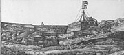
St. Angelo's Fort was built in 1505 by Dom Francisco de Almeida, the first Portuguese Viceroy of India and is on the Arabian sea coast about 2 km from Kannur town. It was attacked in vain by the local Indian ruler Zamorin and kolathiri in the Siege of Cannanore (1507).

Fort at Kannur
On August 1509 Almeida, refusing to recognize Afonso de Albuquerque's as the new Portuguese governor to supersede himself, arrested him in this fortress after having fought the naval Battle of Diu. Afonso de Albuquerque was released after six months' confinement, and become governor on the arrival of the grand-marshal of Portugal with a large fleet, in October 1509.[1]
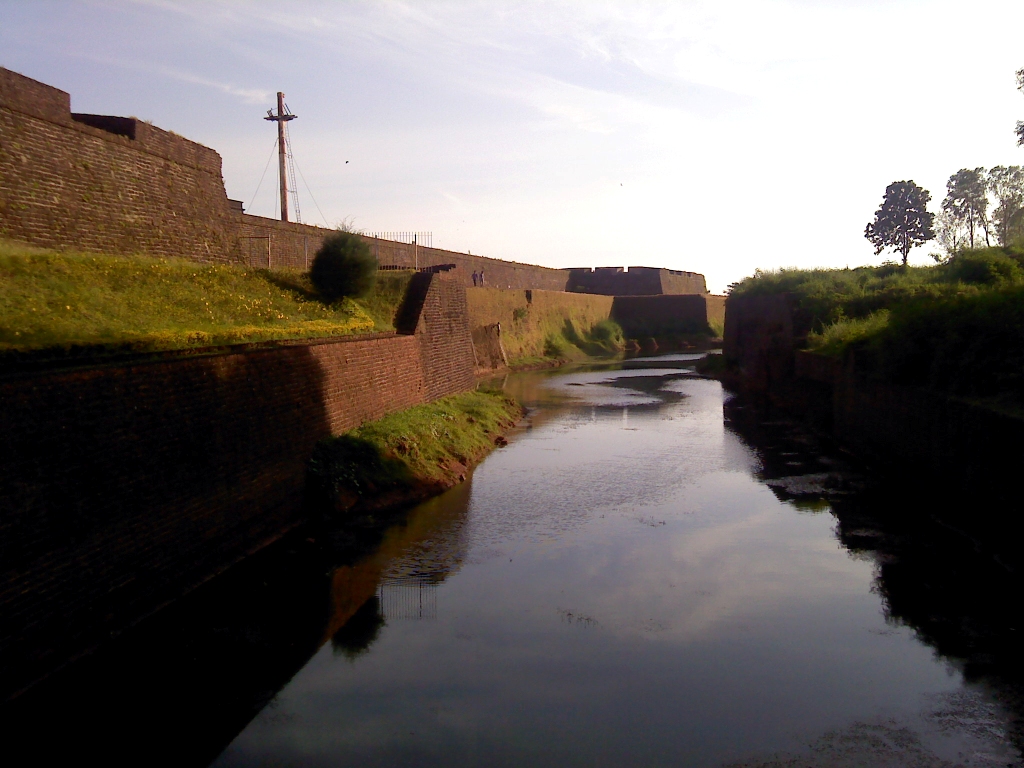
The Dutch captured the fort from the Portuguese in 1663. They modernised the fort and built the bastions Hollandia, Zeelandia and Frieslandia that are the major features of the present structure. The original Portuguese fort was pulled down later. A painting of this fort and the fishing ferry behind it can be seen in the Rijksmuseum Amsterdam. The Dutch sold the fort to king Ali Raja of Arakkal in 1772. In 1790 the British seized it and used it as their chief military station in Malabar until 1947. The fort is in the Cannanore Cantonment area. It is fairly well preserved as a protected monument under the Archaeological Survey of India. St Angelo's fort is a most important historical monument and a popular tourist attraction. Six Tourism Policeman are posted here for protection duty.
Present status[]

St. Angelo Fort
The Moppila Bay Harbor and Arakkal Mosque are near the fort. The fort is now well-maintained under the supervision of the Archaeological Survey of India. Tourists are allowed entry to the fort every day of the week between 8 AM to 6 PM.
Photo Album: St.Angelo's fort[]
")
")
")
")
")
")
")
")
")
")
")
")
")
")
")
See also[]
| Wikimedia Commons has media related to Kannur Fort. |
- Arakkal Museum
- Cannanore Lighthouse
- Cannanore Cantonment
- Payyambalam Beach
- Meenkunnu Beach
- Muzhappilangad Beach
- Parassinikkadavu Snake Park
- Muthappan temple
- Kannur
- Thalassery Fort
References[]
- ↑ Neto, Ricardo Bonalume (2002-04-01). "Lightning rod of Portuguese India". MHQ: The Quarterly Journal of Military History. Cowles Enthusiast Media Spring. p. 68.
Coordinates: 11°51′15″N 75°22′19″E / 11.854200°N 75.371811°E
| ||||||||||||||||||||||||||||||||||||||||||||||||||||||||||||||
The original article can be found at St. Angelo Fort and the edit history here.