
Political Map: the Kashmir region districts, showing the Pir Panjal range and the Kashmir Valley or Vale of Kashmir.

Ninth-highest: Nanga Parbat, a dangerous mountain to climb, is in the Kashmiri region of Gilgit–Baltistan in Pakistan
Kashmir (Kashmiri language: کٔشِیر / कॅशीर; Hindi language: कश्मीर; Urdu language: کشمیر
- Uyghur
- كەشمىر; Shina language: کشمیر) is the northwestern region of the Indian subcontinent. Until the mid-19th century, the term Kashmir geographically denoted only the valley between the Great Himalayas and the Pir Panjal mountain range. Today, it denotes a larger area that includes the Indian-administered state of Jammu and Kashmir (which consists of Jammu, Kashmir Valley, and the Ladakh regions), the Pakistan-administered territories of Azad Kashmir and Gilgit–Baltistan, and the Chinese-administered regions of Aksai Chin and the Trans-Karakoram Tract.
In the first half of the 1st millennium, the Kashmir region became an important centre of Hinduism and later of Buddhism; later still, in the ninth century, Kashmir Shaivism arose.[1] In 1349, Shah Mir became the first Muslim ruler of Kashmir, inaugurating the Salatin-i-Kashmir or Swati dynasty.[2] For the next five centuries, Muslim monarchs ruled Kashmir, including the Mughals, who ruled from 1526 until 1751, and the Afghan Durrani Empire, which ruled from 1747 until 1820.[2] That year, the Sikhs, under Ranjit Singh, annexed Kashmir.[2] In 1846, after the Sikh defeat in the First Anglo-Sikh War, and upon the purchase of the region from the British under the Treaty of Amritsar, the Raja of Jammu, Gulab Singh, became the new ruler of Kashmir. The rule of his descendants, under the paramountcy (or tutelage) of the British Crown, lasted until 1947, when the former princely state became a disputed territory, now administered by three countries: India, Pakistan, and the People's Republic of China.
Etymology[]
The word Kashmir is derived from Sanskrit कश्मीर (káśmīra).[3]
History[]

General view of Temple and Enclosure of Marttand (the Sun), at Bhawan, ca. 490–555; the colonnade ca. 693–729. Surya Mandir at Martand, Jammu & Kashmir, India, photographed by John Burke, 1868.
Buddhism in Kashmir[]


This general view of the unexcavated Buddhist stupa near Baramulla, with two figures standing on the summit, and another at the base with measuring scales, was taken by John Burke in 1868. The stupa, which was later excavated, dates to 500 CE.
The Buddhist Mauryan emperor Ashoka is often credited with having founded the old capital of Kashmir, Shrinagari, now ruins on the outskirts of modern Srinagar. Kashmir was long to be a stronghold of Buddhism.[4]
As a Buddhist seat of learning, the Sarvāstivādan school strongly influenced Kashmir.[5] East and Central Asian Buddhist monks are recorded as having visited the kingdom. In the late 4th century CE, the famous Kuchanese monk Kumārajīva, born to an Indian noble family, studied Dīrghāgama and Madhyāgama in Kashmir under Bandhudatta. He later became a prolific translator who helped take Buddhism to China. His mother Jīva is thought to have retired to Kashmir. Vimalākṣa, a Sarvāstivādan Buddhist monk, travelled from Kashmir to Kucha and there instructed Kumārajīva in the Vinayapiṭaka.
Adi Shankara visited the pre-existing Sarvajñapīṭha (Sharada Peeth) in Kashmir in late 8th century or early 9th century CE. The Madhaviya Shankaravijayam states this temple had four doors for scholars from the four cardinal directions. The southern door (representing South India) had never been opened, indicating that no scholar from South India had entered the Sarvajna Pitha. Adi Shankara opened the southern door by defeating in debate all the scholars there in all the various scholastic disciplines such as Mimamsa, Vedanta and other branches of Hindu philosophy; he ascended the throne of Transcendent wisdom of that temple.[6]
Abhinavagupta (approx. 950 – 1020 CE[7][8]) was one of India's greatest philosophers, mystics and aestheticians. He was also considered an important musician, poet, dramatist, exeget, theologian, and logician[9][10] – a polymathic personality who exercised strong influences on Indian culture.[11][12] He was born in the Valley of Kashmir[13] in a family of scholars and mystics and studied all the schools of philosophy and art of his time under the guidance of as many as fifteen (or more) teachers and gurus.[14] In his long life he completed over 35 works, the largest and most famous of which is Tantrāloka, an encyclopaedic treatise on all the philosophical and practical aspects of Trika and Kaula (known today as Kashmir Shaivism). Another one of his very important contributions was in the field of philosophy of aesthetics with his famous Abhinavabhāratī commentary of Nāṭyaśāstra of Bharata Muni.[15]
In the 10th century CE Moksopaya or Moksopaya Shastra, a philosophical text on salvation for non-ascetics (moksa-upaya: 'means to release'), was written on the Pradyumna hill in Śrīnagar.[16][17] It has the form of a public sermon and claims human authorship and contains about 30,000 shloka's (making it longer than the Ramayana). The main part of the text forms a dialogue between Vasistha and Rama, interchanged with numerous short stories and anecdotes to illustrate the content.[18][19] This text was later (11th to the 14th century CE)[20] expanded and vedanticised, which resulted in the Yoga Vasistha.[21]
Muslim rule[]
|
|
This section is empty. You can help by adding to it. |


Gateway of enclosure, (once a Hindu temple) of Zein-ul-ab-ud-din's Tomb, in Srinagar. Probable date A.D. 400 to 500, 1868. John Burke. Oriental and India Office Collection. British Library.
Sikh rule[]
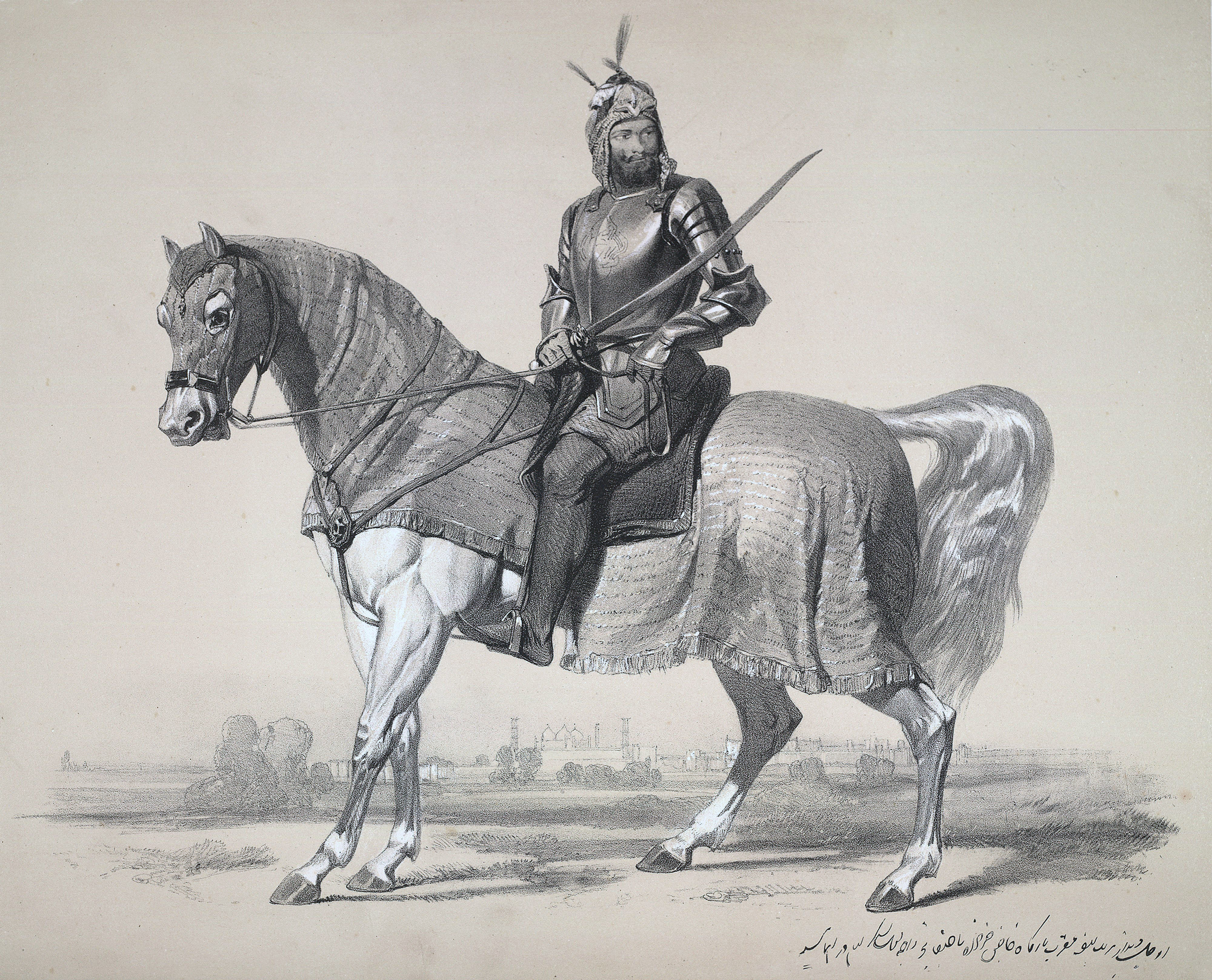

Raja Lal Singh led the Sikh forces against the British in the First Anglo-Sikh War (1845–46) and was defeated in the Battle of Sobraon on 10 February 1846. Under the terms of the Treaty of Lahore, Lal Singh surrender Kashmir which the British sold to the Dogra ruler of Jamu, Raja Gulab Singh, an ally of the British, at a nominal price.
In 1819, the Kashmir valley passed from the control of the Durrani Empire of Afghanistan, and four centuries of Muslim rule under the Mughals and the Afghans, to the conquering armies of the Sikhs under Ranjit Singh of Lahore.[22] As the Kashmiris had suffered under the Afghans, they initially welcomed the new Sikh rulers.[23] However, the Sikh governors turned out to be hard taskmasters, and Sikh rule was generally considered oppressive,[24] protected perhaps by the remoteness of Kashmir from the capital of the Sikh empire in Lahore.[25] The Sikhs enacted a number of anti-Muslim laws,[25] which included handing out death sentences for cow slaughter,[23] closing down the Jamia Masjid in Srinagar,[25] and banning the azaan, the public Muslim call to prayer.[25] Kashmir had also now begun to attract European visitors, several of whom wrote of the abject poverty of the vast Muslim peasantry and of the exorbitant taxes under the Sikhs.[23] High taxes, according to some contemporary accounts, had depopulated large tracts of the countryside, allowing only one-sixteenth of the cultivable land to be cultivated.[23] However, after a famine in 1832, the Sikhs reduced the land tax to half the produce of the land and also began to offer interest-free loans to farmers;[25] Kashmir became the second highest revenue earner for the Sikh empire.[25] During this time Kashmiri shawls became known worldwide, attracting many buyers, especially in the West.[25]
Earlier, in 1780, after the death of Ranjit Deo, the Raja of Jammu, the kingdom of Jammu (to the south of the Kashmir valley) was also captured by the Sikhs and afterwards, until 1846, became a tributary to Sikh power.[22] Ranjit Deo's grandnephew, Gulab Singh, subsequently sought service at the court of Ranjit Singh, distinguished himself in later campaigns, especially the annexation of the Kashmir valley, and, for his services, was appointed governor of Jammu in 1820. With the help of his officer, Zorawar Singh, Gulab Singh soon captured for the Sikhs the lands of Ladakh and Baltistan to the east and north-east, respectively, of Jammu.[22]
Princely state[]
1909 Map of the Princely State of Kashmir and Jammu. The names of regions, important cities, rivers, and mountains are underlined in red.
In 1845, the First Anglo-Sikh War broke out. According to the Imperial Gazetteer of India,
"Gulab Singh contrived to hold himself aloof till the battle of Sobraon (1846), when he appeared as a useful mediator and the trusted adviser of Sir Henry Lawrence. Two treaties were concluded. By the first the State of Lahore (i.e. West Punjab) handed over to the British, as equivalent for one crore indemnity, the hill countries between the rivers Beas and Indus; by the second the British made over to Gulab Singh for 7.5 million all the hilly or mountainous country situated to the east of the Indus and the west of the Ravi i.e. the Vale of Kashmir)."[22]
Drafted by a treaty and a bill of sale, and constituted between 1820 and 1858, the Princely State of Kashmir and Jammu (as it was first called) combined disparate regions, religions, and ethnicities:[26] to the east, Ladakh was ethnically and culturally Tibetan and its inhabitants practised Buddhism; to the south, Jammu had a mixed population of Hindus, Muslims and Sikhs; in the heavily populated central Kashmir valley, the population was overwhelmingly Sunni Muslim, however, there was also a small but influential Hindu minority, the Kashmiri brahmins or pandits; to the northeast, sparsely populated Baltistan had a population ethnically related to Ladakh, but which practised Shi'a Islam; to the north, also sparsely populated, Gilgit Agency, was an area of diverse, mostly Shi'a groups; and, to the west, Punch was Muslim, but of different ethnicity than the Kashmir valley.[26] After the Indian Rebellion of 1857, in which Kashmir sided with the British, and the subsequent assumption of direct rule by Great Britain, the princely state of Kashmir came under the suzerainty of the British Crown.
In the British census of India of 1941, Kashmir registered a Muslim majority population of 77%, a Hindu population of 20% and a sparse population of Buddhists and Sikhs comprising the remaining 3%.[27] That same year, Prem Nath Bazaz, a Kashmiri Pandit journalist wrote: “The poverty of the Muslim masses is appalling. ... Most are landless laborers, working as serfs for absentee [Hindu] landlords ... Almost the whole brunt of official corruption is borne by the Muslim masses.”[28] For almost a century until the census, a small Hindu elite had ruled over a vast and impoverished Muslim peasantry.[27][29] Driven into docility by chronic indebtedness to landords and moneylenders, having no education besides, nor awareness of rights,[27] the Muslim peasants had no political representation until the 1930s.[29]
1947 and 1948[]

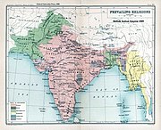
The prevailing religions by district in the 1901 Census of the Indian Empire.
Ranbir Singh's grandson Hari Singh, who had ascended the throne of Kashmir in 1925, was the reigning monarch in 1947 at the conclusion of British rule of the subcontinent and the subsequent partition of the British Indian Empire into the newly independent Union of India and the Dominion of Pakistan. According to Burton Stein's History of India,
"Kashmir was neither as large nor as old an independent state as Hyderabad; it had been created rather off-handedly by the British after the first defeat of the Sikhs in 1846, as a reward to a former official who had sided with the British. The Himalayan kingdom was connected to India through a district of the Punjab, but its population was 77 per cent Muslim and it shared a boundary with Pakistan. Hence, it was anticipated that the maharaja would accede to Pakistan when the British paramountcy ended on 14–15 August. When he hesitated to do this, Pakistan launched a guerrilla onslaught meant to frighten its ruler into submission. Instead the Maharaja appealed to Mountbatten[30] for assistance, and the governor-general agreed on the condition that the ruler accede to India. Indian soldiers entered Kashmir and drove the Pakistani-sponsored irregulars from all but a small section of the state. The United Nations was then invited to mediate the quarrel. The UN mission insisted that the opinion of Kashmiris must be ascertained, while India insisted that no referendum could occur until all of the state had been cleared of irregulars."[31]
In the last days of 1948, a ceasefire was agreed under UN auspices. However, since the plebiscite demanded by the UN was never conducted, relations between India and Pakistan soured,[31] and eventually led to two more wars over Kashmir in 1965 and 1999. India has control of about half the area of the former princely state of Jammu and Kashmir, while Pakistan controls a third of the region, the Northern Areas and Azad Kashmir. According to Encyclopædia Britannica, "Although there was a clear Muslim majority in Kashmir before the 1947 partition and its economic, cultural, and geographic contiguity with the Muslim-majority area of the Punjab (in Pakistan) could be convincingly demonstrated, the political developments during and after the partition resulted in a division of the region. Pakistan was left with territory that, although basically Muslim in character, was thinly populated, relatively inaccessible, and economically underdeveloped. The largest Muslim group, situated in the Valley of Kashmir and estimated to number more than half the population of the entire region, lay in Indian-administered territory, with its former outlets via the Jhelum valley route blocked."[32]


The Karakash River (Black Jade River) which flows north from its source near the town of Sumde in Aksai Chin, to cross the Kunlun Mountains.


Topographic map of Kasmir.
Current status and political divisions[]
The eastern region of the former princely state of Kashmir has also been involved in a boundary dispute. In the late 19th- and early 20th centuries, although some boundary agreements were signed between Great Britain, Afghanistan and Russia over the northern borders of Kashmir, China never accepted these agreements, and the PRC's official position did not change with the communist revolution in 1949. By the mid-1950s the Chinese army had entered the north-east portion of Ladakh.[32]
- "By 1956–57 they had completed a military road through the Aksai Chin area to provide better communication between Xinjiang and western Tibet. India's belated discovery of this road led to border clashes between the two countries that culminated in the Sino-Indian war of October 1962."[32]
The region is divided amongst three countries in a territorial dispute: Pakistan controls the northwest portion (Northern Areas and 'Azad' Kashmir), India controls the central and southern portion (Jammu and Kashmir) and Ladakh, and the People's Republic of China controls the northeastern portion (Aksai Chin and the Trans-Karakoram Tract). India controls the majority of the Siachen Glacier area, including the Saltoro Ridge passes, whilst Pakistan controls the lower territory just southwest of the Saltoro Ridge. India controls 101,338 km2 (39,127 sq mi) of the disputed territory, Pakistan controls 85,846 km2 (33,145 sq mi), and the People's Republic of China controls the remaining 37,555 km2 (14,500 sq mi).
Jammu and Pakistan administered Kashmir lie outside Pir Panjal range, and are under Indian and Pakistani control respectively. These are populous regions. The main cities are Mirpur, Dadayal, Kotli, Bhimber Jammu, Muzaffarabad and Rawalakot.
The Gilgit–Baltistan, formerly called Northern Areas, are a group of territories in the extreme north, bordered by the Karakoram, the western Himalayas, the Pamir, and the Hindu Kush ranges. With its administrative centre at the town of Gilgit, the Northern Areas cover an area of 72,971 km² (28,174 mi²) and have an estimated population approaching 1 million (10 lacs). The other main city is Skardu.
Ladakh is a region in the east, between the Kunlun mountain range in the north and the main Great Himalayas to the south.[33] Main cities are Leh and Kargil. It is under Indian administration and is part of the state of Jammu and Kashmir. It is one of the most sparsely populated regions in the area and is mainly inhabited by people of Indo-Aryan and Tibetan descent.[33]
Aksai Chin is a vast high-altitude desert of salt that reaches altitudes up to 5,000 metres (16,000 ft). Geographically part of the Tibetan Plateau, Aksai Chin is referred to as the Soda Plain. The region is almost uninhabited, and has no permanent settlements.
Though these regions are in practice administered by their respective claimants, neither India nor Pakistan has formally recognised the accession of the areas claimed by the other. India claims those areas, including the area "ceded" to China by Pakistan in the Trans-Karakoram Tract in 1963, are a part of its territory, while Pakistan claims the entire region excluding Aksai Chin and Trans-Karakoram Tract. The two countries have fought several declared wars over the territory. The Indo-Pakistani War of 1947 established the rough boundaries of today, with Pakistan holding roughly one-third of Kashmir, and India one-half, with a dividing line of control established by the United Nations. The Indo-Pakistani War of 1965 resulted in a stalemate and a UN-negotiated ceasefire.
Demographics[]
In the 1901 Census of the British Indian Empire, the population of the princely state of Kashmir and Jammu was 2,905,578. Of these, 2,154,695 (74.16%) were Muslims, 689,073 (23.72%) Hindus, 25,828 (0.89%) Sikhs, and 35,047 (1.21%) Buddhists (implying 935 (0.032%) others).
The Hindus were found mainly in Jammu, where they constituted a little less than 70% of the population.[34] In the Kashmir Valley, Muslims constituted 95.6% of the population and Hindus 3.24%.[34] These percentages have remained fairly stable for the last 100 years.[35] Forty years later, in the 1941 Census of British India, Muslims accounted for 93.6% of the population of the Kashmir Valley and the Hindus for 4%.[35] In 2003, the percentage of Muslims in the Kashmir Valley was 95%[36] and those of Hindus 4%; the same year, in Jammu, the percentage of Hindus was 66% and those of Muslims 30%.[36]
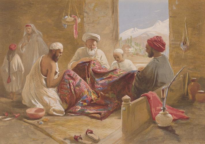

.jpg)
A Muslim shawl making family shown in Cashmere shawl manufactory, 1867, chromolith., William Simpson.
Among the Muslims of the princely state, four divisions were recorded: "Shaikhs, Saiyids, Mughals, and Pathans. The Shaikhs, who are by far the most numerous, are the descendants of Hindus, but have retained none of the caste rules of their forefathers. They have clan names known as krams ..."[34] It was recorded that these kram names included "Tantre", "Shaikh", "Bhat", "Mantu", "Ganai", "Dar", "Damar", "Lon", etc. The Saiyids, it was recorded, "could be divided into those who follow the profession of religion and those who have taken to agriculture and other pursuits. Their kram name is 'Mir.' While a Saiyid retains his saintly profession Mir is a prefix; if he has taken to agriculture, Mir is an affix to his name."[34][Clarification needed] The Mughals who were not numerous were recorded to have kram names like "Mir" (a corruption of "Mirza"), "Beg", "Bandi", "Bach" and "Ashaye". Finally, it was recorded that the Pathans "who are more numerous than the Mughals, ... are found chiefly in the south-west of the valley, where Pathan colonies have from time to time been founded. The most interesting of these colonies is that of Kuki-Khel Afridis at Dranghaihama, who retain all the old customs and speak Pashtu."[34] Among the main tribes of Muslims in the princely state are the Butts, Dar, Lone, Jat, Gujjar, Rajput, Sudhan and Khatri. A small number of Butts, Dar and Lone use the title Khawaja and the Khatri use the title Shaikh the Gujjar use the title of Chaudhary. All these tribes are indigenous of the princely state and many Hindus also belong to these tribes.
The Hindus were found mainly in Jammu, where they constituted a little less than 60% of the population.[34] In the Kashmir Valley, the Hindus represented "524 in every 10,000 of the population (i.e. 5.24%), and in the frontier wazarats of Ladhakh and Gilgit only 94 out of every 10,000 persons (0.94%)."[34] In the same Census of 1901, in the Kashmir Valley, the total population was recorded to be 1,157,394, of which the Muslim population was 1,083,766, or 93.6% and the Hindu population 60,641.[34] Among the Hindus of Jammu province, who numbered 626,177 (or 90.87% of the Hindu population of the princely state), the most important castes recorded in the census were "Brahmans (186,000), the Rajputs (167,000), the Khattris (48,000) and the Thakkars (93,000)."[34]
In the 1911 Census of the British Indian Empire, the total population of Kashmir and Jammu had increased to 3,158,126. Of these, 2,398,320 (75.94%) were Muslims, 696,830 (22.06%) Hindus, 31,658 (1%) Sikhs, and 36,512 (1.16%) Buddhists. In the last census of British India in 1941, the total population of Kashmir and Jammu (which as a result of the second world war, was estimated from the 1931 census) was 3,945,000. Of these, the total Muslim population was 2,997,000 (75.97%), the Hindu population was 808,000 (20.48%), and the Sikh 55,000 (1.39%).[37]
The Kashmiri Pandits, the only Hindus of the Kashmir valley, who had stably constituted approximately 4 to 5% of the population of the valley during Dogra rule (1846–1947), and 20% of whom had left the Kashmir valley by 1950,[38] began to leave in much greater numbers in the 1990s. According to a number of authors, approximately 100,000 of the total Kashmiri Pandit population of 140,000 left the valley during that decade.[39] Other authors have suggested a higher figure for the exodus, ranging from the entire population of over 150[40] to 190 thousand (1.5 to 190,000) of a total Pandit population of 200 thousand (200,000)[41] to a number as high as 300 thousand[42] (300,000).
The total population of India's division of Jammu and Kashmir is 12,541,302[43] and Pakistan's division of Azad Jammu and Kashmir is 2,580,000 and Gilgit-Baltistan is 870,347.[44]
| Administered by | Area | Population | % Muslim | % Hindu | % Buddhist | % Other |
|---|---|---|---|---|---|---|
| Kashmir Valley | ~4 million (4 million) | 95% | 4%* | – | – | |
| Jammu | ~3 million (3 million) | 30% | 66% | – | 4% | |
| Ladakh | ~0.25 million (250,000) | 46% | – | 50% | 3% | |
| Azad Kashmir | ~2.6 million (2.6 million) | 100% | – | – | – | |
| Gilgit–Baltistan | ~1 million (1 million) | 99% | – | – | – | |
| Aksai Chin | – | – | – | – | – | |
| ||||||
Culture and cuisine[]
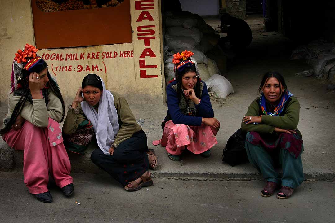

Brokpa women from Kargil, northern Ladakh, in local costumes
Kashmiri cuisine includes dum aloo (boiled potatoes with heavy amounts of spice), tzaman (a solid cottage cheese), rogan josh (lamb cooked in heavy spices), yakhiyn (lamb cooked in curd with mild spices), hakh (a spinach-like leaf), rista-gushtaba (minced meat balls in tomato and curd curry), danival korme, and the signature rice which is particular to Asian cultures.
The traditional wazwan feast involves cooking meat or vegetables, usually mutton, in several different ways. Alcohol is strictly prohibited in most places.
There are two styles of making tea in the region: Noon Chai, or salt tea, which is pink in colour (known as chinen posh rang or peach flower colour) and popular with locals; and kahwah, a tea for festive occasions, made with saffron and spices (cardamom, cinamon, sugar, noon chai leaves), and black tea.
Economy[]


Tourism is one of the main sources of income for vast sections of the Kashmiri population. Shown here is the famous Dal Lake in Srinagar, India.


Skardu in the Northern Areas, is the point of departure for mountaineering expeditions in the Karakorams.
Kashmir's economy is centred around agriculture. Traditionally the staple crop of the valley was rice, which formed the chief food of the people. In addition, Indian corn, wheat, barley and oats were also grown. Given its temperate climate, it is suited for crops like asparagus, artichoke, seakale, broad beans, scarletrunners, beetroot, cauliflower and cabbage. Fruit trees are common in the valley, and the cultivated orchards yield pears, apples, peaches, and cherries. The chief trees are deodar, firs and pines, chenar or plane, maple, birch and walnut, apple, cherry.
Historically, Kashmir became known worldwide when Cashmere wool was exported to other regions and nations (exports have ceased due to decreased abundance of the cashmere goat and increased competition from China). Kashmiris are well adept at knitting and making Pashmina shawls, silk carpets, rugs, kurtas, and pottery. Saffron, too, is grown in Kashmir. Efforts are on to export the naturally grown fruits and vegetables as organic foods mainly to the Middle East. Srinagar is known for its silver-work, papier mache, wood-carving, and the weaving of silk.
The economy was badly damaged by the 2005 Kashmir earthquake which, as of 8 October 2005, resulted in over 70,000 deaths in the Pakistan-controlled part of Kashmir and around 1,500 deaths in Indian controlled Kashmir.
The Indian-administered portion of Kashmir is believed to have potentially rich rocks containing hydrocarbon reserves.[45][46]
Transport[]
Transport is predominantly by air or road vehicles in the region.[47] Kashmir has a 119 km (74 mi) long modern railway line that started in October 2009 and connects Baramulla in the western part of Kashmir to Srinagar and Qazigund. It will link the Kashmir to Banihal across the Pir Panjal mountains through the Banihal rail tunnel in 2013 and to the rest of India in another few years as the construction of the railway line from Jammu to Banihal progresses steadily.
History of tourism in Kashmir[]
The state of Jammu & Kashmir is a region of widely varying people and geography. In the south, Jammu is a transition zone from the Indian plains to the Himalayas. Nature has lavishly endowed Kashmir with certain distinctive features that are paralleled by few alpine regions in the world. It is the land of snow clad mountains that shares a common boundary with Afghanistan, China and Pakistan. Jammu and Kashmir is the northernmost state of the Indian Union. Known for its extravagant natural beauty this land formed a major caravan route in ancient times.
Trade relations through these routes between China and Central Asia made it a land inhabited by various religious and cultural groups. It was during the reign of Kashyapa that the various wandering groups led a settled life; Buddhist influenced Kashmir during the rule of Ashoka and the present town of Srinagar were founded by Kashyapa. This place was earlier called 'Srinagari' or Purandhisthan. The Brahmins who inhabited these areas admired and adored Buddhism too. From the regions of Kashmir Buddhism spread throughout Ladakh, Tibet, Central Asia and China. Various traditions co-existed until the advent of the Muslims.
The Mughal had a deep influence on this land and introduced various reforms in the revenue industry and other areas that added to the progress of Kashmir. In 1820 Maharaj Gulab Singh got the Jagir of Jammu from Maharaj Ranjit Sigh. He is said to have laid the foundation of the Dogra dynasty. In 1846 Kashmir was sold to Maharaj Gulab Singh. Thus the two areas of Kashmir and Jammu were integrated into a single political unit. A few chieftains who formed part of the administration were of the Hunza, Kishtwar, Gilgit Ladakh. During the Dogra dynasty trade improved, along with the preservation and promotion of forestry.
See also[]
- United Nations Security Council Resolution 47
- Line of Control
- Kashmir conflict
- List of Kashmiri people
- Kargil War
- 2005 Kashmir earthquake
- List of Jammu and Kashmir related articles
Notes[]
- ↑ Basham, A. L. (2005) The wonder that was India, Picador. Pp. 572. ISBN 0-330-43909-X, p. 110.
- ↑ 2.0 2.1 2.2 Imperial Gazetteer of India, volume 15. 1908. Oxford University Press, Oxford and London. pp. 93–95.
- ↑ http://dsalsrv02.uchicago.edu/cgi-bin/philologic/getobject.pl?c.0:1:2152.soas
- ↑ A.K. Warder, Indian Buddhism. Motilal Banarsidass 2000, page 256.
- ↑ A.K. Warder, Indian Buddhism. Motilal Banarsidass 2000, pages 263–264.
- ↑ Tapasyananda, Swami (2002). "Sankara-Dig-Vijaya". pp. 186–195.
- ↑ Triadic Heart of Shiva, Paul E. Muller-Ortega, page 12
- ↑ Introduction to the Tantrāloka, Navjivan Rastogi, page 27
- ↑ Key to the Vedas, Nathalia Mikhailova, page 169
- ↑ The Pratyabhijñā Philosophy, Ganesh Vasudeo Tagare, page 12
- ↑ Companion to Tantra, S.C. Banerji, page 89
- ↑ Doctrine of Divine Recognition, K. C. Pandey, page V
- ↑ Introduction to the Tantrāloka, Navjivan Rastogi, page 35
- ↑ Luce dei Tantra, Tantrāloka, Abhinavagupta, Raniero Gnoli, page LXXVII
- ↑ Slaje, Walter. (2005). "Locating the Mokṣopāya", in: Hanneder, Jürgen (Ed.). The Mokṣopāya, Yogavāsiṣṭha and Related Texts Aachen: Shaker Verlag. (Indologica Halensis. Geisteskultur Indiens. 7). p. 35.
- ↑ Gallery – The journey to the Pradyumnaśikhara
- ↑ Leslie 2003, pp. 104–107
- ↑ Lekh Raj Manjdadria. (2002?) The State of Research to date on the Yogavastha (Moksopaya).
- ↑ Hanneder, Jürgen; Slaje, Walter. Moksopaya Project: Introduction.
- ↑ Chapple, Christopher; translation: Venkatesananda, Swami (1984). "The Concise Yoga Vāsiṣṭha". Albany: State University of New York Press. pp. x–xi. ISBN 0-87395-955-8. OCLC 11044869. http://books.google.com/books?id=1FFdOj2dv8cC.
- ↑ 22.0 22.1 22.2 22.3 Imperial Gazetteer of India, volume 15. 1908. "Kashmir: History". pp. 94–95.
- ↑ 23.0 23.1 23.2 23.3 Schofield 2010, pp. 5–6
- ↑ Madan 2008, p. 15
- ↑ 25.0 25.1 25.2 25.3 25.4 25.5 25.6 Zutshi 2003, pp. 39–41
- ↑ 26.0 26.1 Bowers, Paul. 2004. "Kashmir". Research Paper 4/28, International Affairs and Defence, House of Commons Library, United Kingdom.
- ↑ 27.0 27.1 27.2 Bose 2005, pp. 15–17
- ↑ Quoted in Bose 2005, pp. 15–17
- ↑ 29.0 29.1 Talbot & Singh 2009, p. 54
- ↑ Viscount Louis Mountbatten, the last Viceroy of British India, stayed on in independent India from 1947 to 1948, serving as the first Governor-General of the Union of India.
- ↑ 31.0 31.1 Stein, Burton. 2010. A History of India. Oxford University Press. 432 pages. ISBN 978-1-4051-9509-6. Page 358.
- ↑ 32.0 32.1 32.2 Kashmir. (2007). In Encyclopædia Britannica. Retrieved 27 March 2007, from Encyclopædia Britannica Online.
- ↑ 33.0 33.1 Jina, Prem Singh (1996). "Ladakh: The Land and the People". Indus Publishing. ISBN 81-7387-057-8.
- ↑ 34.0 34.1 34.2 34.3 34.4 34.5 34.6 34.7 34.8 Imperial Gazetteer of India, volume 15. 1908. Oxford University Press, Oxford and London. pp. 99–102.
- ↑ 35.0 35.1 Rai, Mridu. 2004. Hindu Ruler, Muslim Subjects: Islam and the History of Kashmir. Princeton University Press. 320 pages. ISBN 0-691-11688-1. p. 37.
- ↑ 36.0 36.1 BBC. 2003. The Future of Kashmir? In Depth.
- ↑ Brush, J. E. 1949. "The Distribution of Religious Communities in India" Annals of the Association of American Geographers, 39(2):81–98.
- ↑ Zutshi 2003, p. 318 Quote: "Since a majority of the landlords were Hindu, the (land) reforms (of 1950) led to a mass exodus of Hindus from the state. ... The unsettled nature of Kashmir's accession to India, coupled with the threat of economic and social decline in the face of the land reforms, led to increasing insecurity among the Hindus in Jammu, and among Kashmiri Pandits, 20 per cent of whom had emigrated from the Valley by 1950."
- ↑ Bose 1997, p. 71, Rai 2004, p. 286, Metcalf & Metcalf 2006, p. 274 Quote: "The Hindu Pandits, a small but influential elite community who had secured a favourable position, first under the maharajas, and then under the successive Congress regimes, and proponents of a distinctive Kashmiri culture that linked them to India, felt under siege as the uprising gathered force. Of a population of some 140,000, perhaps 100,000 Pandits fled the state after 1990; their cause was quickly taken up by the Hindu right."
- ↑ Malik 2005, p. 318
- ↑ Madan 2008, p. 25
- ↑ CIA Factbook: India–Transnational Issues
- ↑ http://www.geohive.com/cntry/in-01.aspx
- ↑ http://www.geohive.com/cntry/pakistan.aspx
- ↑ Iftikhar Gilani (22 October 2008). "Italian company to pursue oil exploration in Kashmir". Daily Times. Archived from the original on 31 July 2012. https://archive.is/ZgPD. Retrieved 20 November 2009.
- ↑ Ishfaq-ul-Hassan (22 February 2008). "India, Pakistan to explore oil jointly". Daily News and Analysis. http://www.dnaindia.com/india/report_india-pakistan-to-explore-oil-jointly_1152227. Retrieved 20 November 2009.
- ↑ "Local Transport in Kashmir – Means of Transportation Kashmir – Mode of Transportation Kashmir India". Bharatonline.com. http://www.bharatonline.com/kashmir/travel-tips/local-transport.html. Retrieved 3 August 2012.
 This article incorporates text from a publication now in the public domain: Chisholm, Hugh, ed. Encyclopædia Britannica Cambridge University Press
Cited references[]
- Bose, Sugata; Jalal, Ayesha (2003). "Modern South Asia: History, Culture, Political Economy". London and New York: Routledge, 2nd edition. Pp. xiii, 304. ISBN 0-415-30787-2..
- Bose, Sumantra (1997). "The Challenge in Kashmir: Democracy, Self Determination and a Just Peace". New Delhi: Sage Publications. Pp. 211. ISBN 0-8039-9350-1.
- Bose, Sumantra (2005). "Kashmir: roots of conflict, paths to peace". Harvard University Press. Pp. 307. ISBN 978-0-674-01817-4.
- Brown, Judith M. (1994). "Modern India: The Origins of an Asian Democracy". Oxford and New York: Oxford University Press. Pp. xiii, 474. ISBN 0-19-873113-2..
- Copland, Ian (2002). "Princes of India in the Endgame of Empire, 1917–1947". (Cambridge Studies in Indian History & Society). Cambridge and London: Cambridge University Press. Pp. 316. ISBN 0-521-89436-0..
- Evans, Alexander (2008). "The Valley of Kashmir: The Making and Unmaking of a Composite Culture?". In Rao, Aparna. Delhi: Manohar. Pp. xviii, 758. pp. 713–741. ISBN 978-81-7304-751-0.
- Kaw, Mushtaq A. (2008). "The Valley of Kashmir: The Making and Unmaking of a Composite Culture?". In Rao, Aparna. Delhi: Manohar. Pp. xviii, 758. pp. 207–234. ISBN 978-81-7304-751-0.
- Keenan, Brigid (1989). "Travels in Kashmir: A Popular History of Its People, Places, and Crafts". Delhi: Oxford University Press. Pp. xii, 226. ISBN 0-19-562236-7.
- Khan, Mohammad Ishaq (2008). "The Valley of Kashmir: The Making and Unmaking of a Composite Culture?". In Rao, Aparna. Delhi: Manohar. Pp. xviii, 758. pp. 97–198. ISBN 978-81-7304-751-0.
- Khan, Yasmin (2007). "The Great Partition: The Making of India and Pakistan". New Haven and London: Yale University Press, 250 pages. ISBN 0-300-12078-8.
- Kulke, Hermann; Rothermund, Dietmar (2004). "A History of India". 4th edition. Routledge, Pp. xii, 448. ISBN 0-415-32920-5..
- Lamb, Alastair (1991). "Kashmir: a disputed legacy, 1846–1990". Oxford University Press. Pp. 368. ISBN 978-0-19-577423-8.
- Lamb, Alastair (1997). "Incomplete partition: the genesis of the Kashmir dispute 1947–1948". Roxford. Pp. 374. ISBN 0-907129-08-0.
- Madan, T. N. (2008). "The Valley of Kashmir: The Making and Unmaking of a Composite Culture?". In Rao, Aparna. Delhi: Manohar. Pp. xviii, 758. pp. 1–36. ISBN 978-81-7304-751-0.
- Malik, Iffat (2005). "Kashmir: Ethnic Conflict, International Dispute". Karachi and Oxford: Oxford University Press. Pp. xxvi, 392. ISBN 0-19-579622-5.
- Metcalf, Barbara; Metcalf, Thomas R. (2006). "A Concise History of Modern India (Cambridge Concise Histories)". Cambridge and New York: Cambridge University Press. Pp. xxxiii, 372. ISBN 0-521-68225-8..
- Rai, Mridu (2004). "Hindu Rulers, Muslim Subjects: Islam, Rights, and the History of Kashmir". Princeton University Press/Permanent Black. Pp. xii, 335.. ISBN 81-7824-202-8.
- Ramusack, Barbara (2004). "The Indian Princes and their States (The New Cambridge History of India)". Cambridge and London: Cambridge University Press. Pp. 324. ISBN 0-521-03989-4.
- Rao, Aparna, ed (2008). "The Valley of Kashmir: The Making and Unmaking of a Composite Culture?". Delhi: Manohar. Pp. xviii, 758. ISBN 978-81-7304-751-0.
- Reynolds, Nathalène (2008). "The Valley of Kashmir: The Making and Unmaking of a Composite Culture?". In Rao, Aparna. Delhi: Manohar. Pp. xviii, 758. pp. 563–604. ISBN 978-81-7304-751-0.
- Schaffer, Howard B. (2009). "The Limits of Influence: America's Role in Kashmir". Brookings Institution Press/Viking Penguin India. Pp. xii, 272. ISBN 978-0-670-08372-5.
- Schofield, Victoria (2010). "Kashmir in conflict: India, Pakistan and the unending war". I. B. Tauris. Pp. xvi, 318. ISBN 978-1-84885-105-4.
- Stein, Burton (2001). "A History of India". New Delhi and Oxford: Oxford University Press. Pp. xiv, 432. ISBN 0-19-565446-3..
- Talbot, Ian; Singh, Gurharpal (2009). "The Partition of India". Cambridge University Press. Pp. xviii, 206. ISBN 978-0-521-76177-2.
- Witzel, Michael (2008). "The Valley of Kashmir: The Making and Unmaking of a Composite Culture?". In Rao, Aparna. Delhi: Manohar. Pp. xviii, 758. pp. 37–96. ISBN 978-81-7304-751-0.
- Wolpert, Stanley (2006). "Shameful Flight: The Last Years of the British Empire in India". Oxford and New York: Oxford University Press. Pp. 272. ISBN 0-19-515198-4..
- Zutshi, Chitralekha (2003). "Language of belonging: Islam, regional identity, and the making of Kashmir". Oxford University Press/Permanent Black. Pp. 359. ISBN 978-0-19-521939-5.
- Zutshi, Chitraleka (2008). "The Valley of Kashmir: The Making and Unmaking of a Composite Culture?". In Rao, Aparna. Delhi: Manohar. Pp. xviii, 758. pp. 235–258. ISBN 978-81-7304-751-0.
Further reading[]
- Blank, Jonah. "Kashmir–Fundamentalism Takes Root", Foreign Affairs, 78,6 (November/December 1999): 36–42.
- Drew, Federic. 1877. "The Northern Barrier of India: a popular account of the Jammoo and Kashmir Territories with Illustrations; 1st edition: Edward Stanford, London. Reprint: Light & Life Publishers, Jammu. 1971.
- Evans, Alexander. Why Peace Won't Come to Kashmir, Current History (Vol 100, No 645) April 2001 p. 170-175.
- Hussain, Ijaz. 1998. "Kashmir Dispute: An International Law Perspective", National Institute of Pakistan Studies.
- Irfani, Suroosh, ed "Fifty Years of the Kashmir Dispute": Based on the proceedings of the International Seminar held at Muzaffarabad, Azad Jammu and Kashmir 24–25 August 1997: University of Azad Jammu and Kashmir, Muzaffarabad, AJK, 1997.
- Joshi, Manoj Lost Rebellion: Kashmir in the Nineties (Penguin, New Delhi, 1999).
- Khan, L. Ali The Kashmir Dispute: A Plan for Regional Cooperation 31 Columbia Journal of Transnational Law, 31, p. 495 (1994).
- Knight, E. F. 1893. Where Three Empires Meet: A Narrative of Recent Travel in: Kashmir, Western Tibet, Gilgit, and the adjoining countries. Longmans, Green, and Co., London. Reprint: Ch'eng Wen Publishing Company, Taipei. 1971.
- Knight, William, Henry. 1863. Diary of a Pedestrian in Cashmere and Thibet. Richard Bentley, London. Reprint 1998: Asian Educational Services, New Delhi.
- Köchler, Hans. The Kashmir Problem between Law and Realpolitik. Reflections on a Negotiated Settlement. Keynote speech delivered at the "Global Discourse on Kashmir 2008." European Parliament, Brussels, 1 April 2008.
- Moorcroft, William and Trebeck, George. 1841. Travels in the Himalayan Provinces of Hindustan and the Panjab; in Ladakh and Kashmir, in Peshawar, Kabul, Kunduz, and Bokhara... from 1819 to 1825, Vol. II. Reprint: New Delhi, Sagar Publications, 1971.
- Neve, Arthur. (Date unknown). The Tourist's Guide to Kashmir, Ladakh, Skardo &c. 18th Edition. Civil and Military Gazette, Ltd., Lahore. (The date of this edition is unknown – but the 16th edition was published in 1938).
- Stein, M. Aurel. 1900. Kalhaṇa's Rājataraṅgiṇī–A Chronicle of the Kings of Kaśmīr, 2 vols. London, A. Constable & Co. Ltd. 1900. Reprint, Delhi, Motilal Banarsidass, 1979.
- Younghusband, Francis and Molyneux, Edward 1917. Kashmir. A. & C. Black, London.
- Norelli-Bachelet, Patrizia. "Kashmir and the Convergence of Time, Space and Destiny", 2004; ISBN 0-945747-00-4. First published as a four-part series, March 2002 – April 2003, in 'Prakash', a review of the Jagat Guru Bhagavaan Gopinath Ji Charitable Foundation. [1]
- Muhammad Ayub. An Army; Ita Role & Rule (A History of the Pakistan Army from Independence to Kargil 1947–1999) Rosedog Books, Pittsburgh, Pennsylvania USA 2005. ISBN 0-8059-9594-3.
External links[]
- Kashmir Information Portal
- Instrument of Accession
- United Nations Military Observers Group in Kashmir
- Official website of the Jammu and Kashmir Government (Indian-administered Kashmir)
- Official website of the Azad Jammu and Kashmir Government (Pakistan-administered Kashmir)
- [2] (Kashmir resources)
- Pakistan Medical Education
- Kashmir Watch: Kashmir Conflict News Source
Coordinates: 34°30′00″N 76°00′00″E / 34.5°N 76°E
The original article can be found at Kashmir and the edit history here.