| Royal Air Force Jurby Head | |||
|---|---|---|---|
| IATA: none – ICAO: none | |||
| Summary | |||
| Airport type | Military | ||
| Operator | Royal Air Force | ||
| Location | Jurby, Isle of Man | ||
| Coordinates | 54°20′12″N 004°32′27″W / 54.33667°N 4.54083°WCoordinates: 54°20′12″N 004°32′27″W / 54.33667°N 4.54083°W | ||
| Map | |||
 RAF Jurby Head | |||
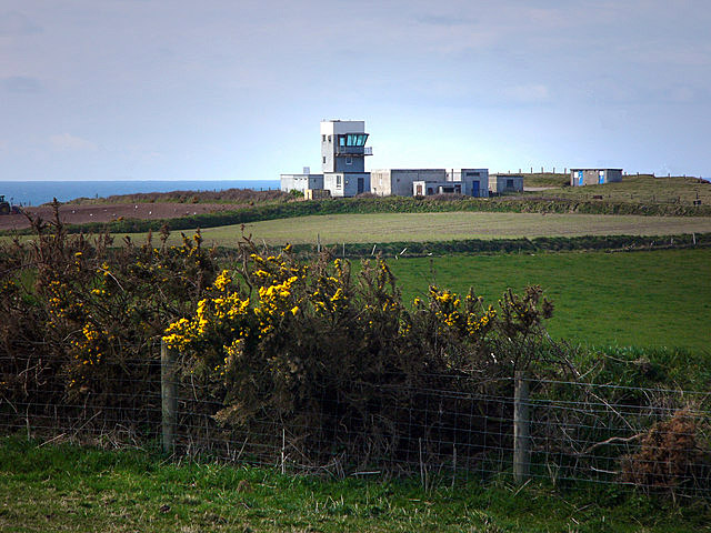
RAF Jurby Head is a former Royal Air Force air weapons range, on the north west coast of the Isle of Man. The range operated between 1939 and 1993.
The station oversaw the use of the air weapons range, which stretched along the shoreline 13 km and 9 km out to sea. Bombing practices were carried out at sea with the use of dummy bombs, including inert nuclear weapons.

R.A.F.Jurby Head.
The main user of the range was the United States Air Force (USAF), but the RAF and other NATO air forces used the range regularly.
Many weapon types were used at Jurby Head ranging in weight up to 1,000 lbs. Most weapons were inert and used for training in targeting.[1]
See also[]
- RAF Jurby, a nearby RAF station
References[]
Citations[]
Bibliography[]
External links[]
| ||||||||||||||||||||||||||||||||

The original article can be found at RAF Jurby Head and the edit history here.