| Scratchbury Camp | |
|---|---|
|
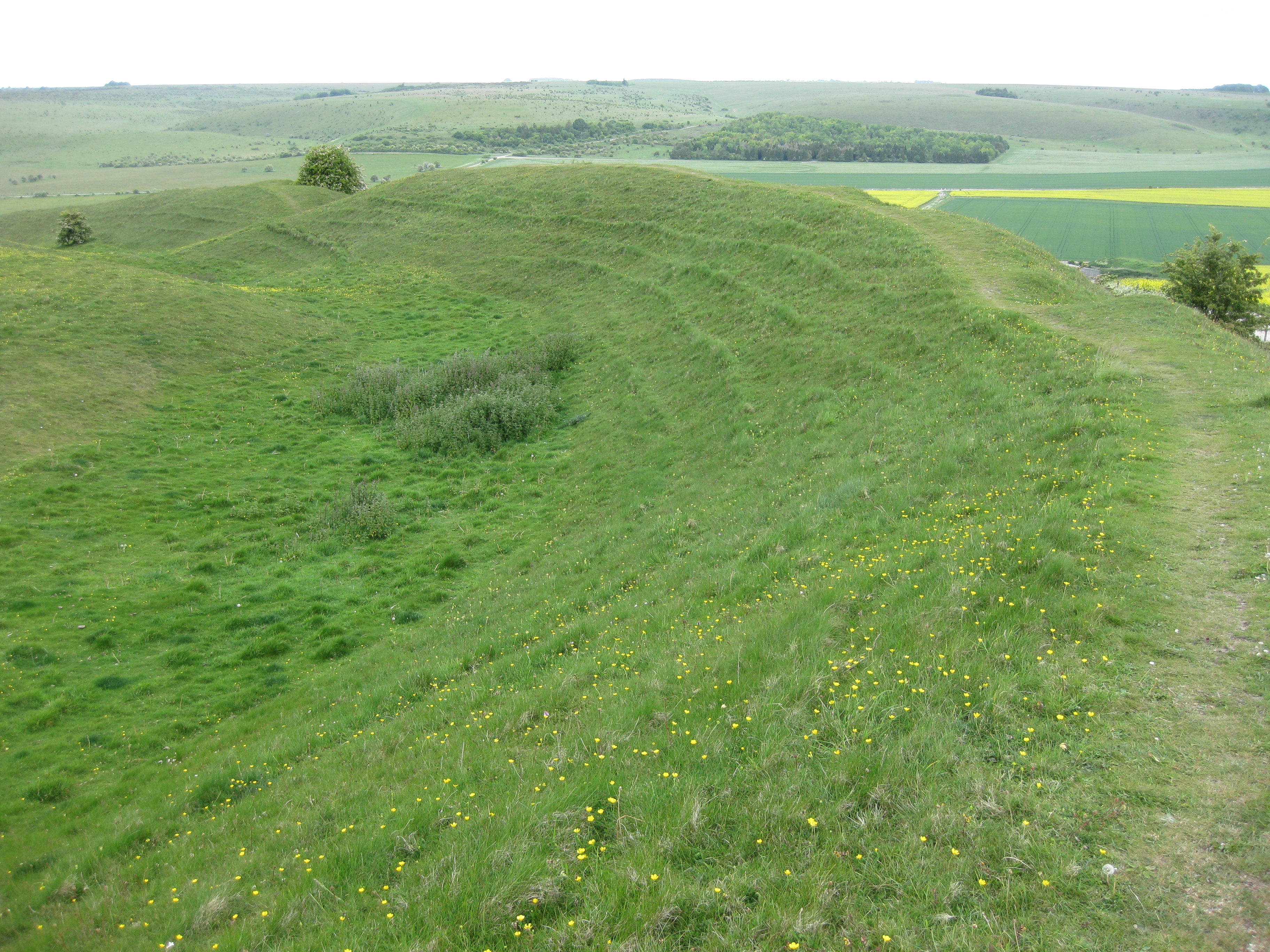
[[File:{{{image_name}}}|240x240px|Scratchbury Camp, viewed from Battlesbury Hill]] Scratchbury Camp, viewed from Battlesbury Hill | |
| Type | Univallate hillfort |
| Location | Wiltshire |
| Coordinates | 51°11′50″N 2°07′39″W / 51.1973°N 2.1274°WCoordinates: 51°11′50″N 2°07′39″W / 51.1973°N 2.1274°W |
| Area | 37 acres (15 ha) |
Scratchbury Camp is the site of an Iron Age univallate hillfort located on Scratchbury Hill, near the village of Norton Bavant in Wiltshire, England. The fort covers an area of 37 acres (15 ha)[1] and occupies the summit of the hill on the edge of Salisbury Plain, with its four-sided shape largely following the natural contours of the hill.
The Iron Age hillfort dates to around 100 BC, but contains the remains of an earlier and smaller D-shaped enclosure or camp. The age of this earlier earthwork is currently subject to debate, and has been variously interpreted due to the inconclusive and incomplete nature of previous and differing excavation records; it may be early Iron Age dating to around 250 BC, but it has also been interpreted as being Bronze Age, dating to around 2000 BC.[2][3]
There are seven tumuli located within the enclosure of the fort, which were excavated in the 19th century by Sir Richard Colt Hoare and William Cunnington. Finds from excavations at that time included relics of bone, pottery, flint, brass, and amber jewellery, most of which can be seen today at the Wiltshire Museum in Devizes.[4] Other items of interest have been found in and around the site including Roman artefacts[5] and neolithic flint and jade axe heads.[5]
The site is listed on Wiltshire Council's Sites and Monuments Record with number ST94SW200, and is also a scheduled monument number SM10213.[6] The hillfort falls within a biological Site of Special Scientific Interest, designated as Scratchbury & Cotley Hills SSSI, which encompasses a total of 53.5 hectares (132 acres), being first SSSI notified in 1951.[7]
Etymology[]
The name of the hill could be derived from a number of old English words and meanings, the etymology of which are ambiguous and open to interpretation, given the differing sources. One possibility is that the name is derived from the words scratch, an old West Country word for the Devil;[8] and bury, from the Old English word beorg, meaning a mound or hill, or sometimes a defense; although it could also be derived from Crech[9] or Crechen[10] meaning a hill, and burh, meaning a fortified town or a defended site.[11]
Background[]
Hill forts developed in the Late Bronze and Early Iron Age, roughly the start of the first millennium BC.[12] The reason for their emergence in Britain, and their purpose, has been a subject of debate. It has been argued that they could have been military sites constructed in response to invasion from continental Europe, sites built by invaders, or a military reaction to social tensions caused by an increasing population and consequent pressure on agriculture. The dominant view since the 1960s has been that the increasing use of iron led to social changes in Britain. Deposits of iron ore were located in different places to the tin and copper ore necessary to make bronze, and as a result trading patterns shifted and the old elites lost their economic and social status. Power passed into the hands of a new group of people.[13] Archaeologist Barry Cunliffe believes that population increase still played a role and has stated "[the forts] provided defensive possibilities for the community at those times when the stress [of an increasing population] burst out into open warfare. But I wouldn't see them as having been built because there was a state of war. They would be functional as defensive strongholds when there were tensions and undoubtedly some of them were attacked and destroyed, but this was not the only, or even the most significant, factor in their construction".[14]
Description[]
Iron Age hillfort[]

Pencil sketch of Scratchbury camp by Sir Richard Colt-Hoare, 1810. The seven tumuli within the hill fort are also shown.[15]
The steeply contoured sides of Scratchbury Hill form natural defences to the north, west and southwestern sides, and in part to a small area of the eastern flank. Elsewhere on the hill the contours are less steep and afford easier access, with the southeastern boundary merging into the adjacent Cotley Hill with only a small change in level. The Iron Age fortifications at Scratchbury Camp consist of a single large ditch and rampart to the most steeply contoured flanks, with some secondary counterscarps to the more accessible sides.[10] The fort, as measured from the ramparts, has a circumference of 1,846 yd (1,688 m)[9]
The inner earthworks are typical of a "quarry-ditch" formation, whereby the material excavated from the inner ditch is used to create the rampart.[16] Within the quarry ditch numerous curvilinear and circular depressions may represent remains of structures.[1] The fortifications are best preserved on the western side of the hill where the ditch is between 5 and 8 metres (16 and 26 ft) wide and up to 1 metre (3.3 ft) deep. The banks and ditches are generally uneven in height and depth, which is thought to be evidence for a 'gang dug' construction of the earthworks.[1] Elsewhere, the enclosure is defined by a bank 3 to 6 metres (9.8 to 19.7 ft) in height above the ditch bottom, the ditch being 4 to 6 metres (13 to 20 ft) wide and up to 0.5 metres (1.6 ft) deep. On parts of the eastern side of the fort the ditch is absent and is replaced by a ledge of between 3 to 8 metres (9.8 to 26.2 ft) wide. There are two original entrances to the fort on the eastern side, and a possible third on the northwest side.[1] The southeastern entrance has earthwork marks representing possible outer fortifications, and is approached from the adjacent Cotley Hill by a narrow ridge of land referred to as Burberry[17]
Much of the north and west areas of the interior appear to have been densely settled, as demonstrated by the traces of approximately 100 probable structures. These survive mainly as shallow circular hollows of between 5 to 10 metres (16 to 33 ft) in diameter and up to 0.6 metres (2.0 ft) deep. The best preserved is a rectangular platform immediately within the southern terminal of the western entrance. The location and unusual morphology suggests a special function for this structure, and it is perhaps plausible that a 'guard chamber' or sentry was positioned here.[1]
Detail of the northeast flank earthwork defences at Scratchbury Camp
Earlier Enclosure[]
Within the centre of the hillfort lies the remains of an earlier and smaller D-shaped inner earthwork enclosure of circa 3.5 hectares (8.6 acres), and excavated by E.C.Curwen in 1930.[18] Today, all that really remains of this enclosure is one well defined lynchet of approximately 0.5 metres (1.6 ft) high along the southern section. This feature bears a resemblance to a similar such enclosure at Yarnbury Castle, and was originally interpreted by Curwen to be a Neolithic causewayed enclosure due to its interrupted nature, and the discovery at the site of jade and flint axes.[1]
Subsequent excavations by Grimes in 1957[19] re-interpreted this feature to be an earlier Iron Age enclosure dating to approximately 250 BC, with Iron Age pottery found within the primary fill. It was therefore speculated that the visible interruptions have been made by post Medieval ploughing.[1] Faint traces of a remnant bank survive along the north and west sections, and an adjoining ditch has a causewayed nature, and survives in short segments varying between 30 to 50 metres (98 to 164 ft) in length. There is also evidence of a single original west facing entrance currently discernible as a 15 metres (49 ft) wide gap in the enclosure boundary. The straight southeastern side of the enclosure is formed by a ditch that is truncated by the main hillfort boundary, and this again has been interpreted as further evidence that the linear ditch and contiguous enclosure pre-date the main hillfort.[1]
However, more recent aerial and photographic surveys have meant that W.F.Grimes' re-interpretation may have been in error. A detailed survey undertaken between 1994 and 1995 by the field survey teams of the Royal Commission on the Historical Monuments of England have suggested that the feature is in fact more likely to be a Neolithic causewayed enclosure as originally interpreted by E.C.Curwen. One possible explanation for the apparent confusion in dating this feature is that Grimes may not have excavated fully to the primary fill. The surveys suggest that the feature clearly has causeways, and low winter sun photography shows that the enclosure continues beyond what was previously believed to be its eastern edge, to form a sub-circular rather than D-shaped enclosure feature.[3] The 'crop mark' visible on aerial photographs shows a continuation of the curve to the southeast of the straight side, thus roughly completing a circle. It should be noted that this feature has also been interpreted as a possible base for a palisaded enclosure. There is also a probable link between the likely neolithic causewayed enclosure and the surrounding barrow cemetery, which would have followed later.[3]

Later Features[]
There is also a Romano-British or later ditch, running east to west, which turns south sharply at the southwest corner of the hillfort, and which partly overlies the earlier Iron Age earthworks. The main ramparts appear to have been built in the 1st century BC.[2][20]
Construction Phases[]


Drawing of finds from the Scratchbury Grave Group, 1869; William Pilsbury after Richard Colt-Hoare (1758–1838); Watercolour on paper, 26.7 x 17.8 (cm); located at the Society of Antiquaries of London
The archaeological evidence suggests that Scratchbury Camp was built in at least two but perhaps three phases.[1] It is generally well accepted that the first phase of construction is defined by the curvilinear portion of the interior 'D'-shaped enclosure,[2] but whether there were distinct second and third Iron Age phases, or merely a re-alignment in the second phase, it is unclear. The scarp subdividing the early fort is a possible indication of a second phase, but this may have been the setting out for a bank that was never utilised. In its third and final phase it seems possible that the fort, having been 'laid out' to include the large barrow, was then further extended to encompass the whole of the top of the hill, to make full defensive use of the natural slopes and resulting in the present day configuration.[1]
Archaeology[]
Excavations at the site have revealed many items from Neolithic, Bronze Age, Iron Age, and Romano-British periods. Most of the finds are now preserved at the Wiltshire Museum in Devizes. Most recently, Professor William Francis Grimes partially excavated the inner earthworks on the site in the 1950s. Finds included Iron Age pottery.[19] In 1880 two Bronze Age axes were apparently found on or near Scratchbury Camp.[5] Both are in private collection; one is a socketed type axe and the other resembles a late North European (Montelius 6) type.[21]
Sir Richard Colt Hoare also records the discoveries of a neolithic jade axe and a ground flint axe, along with various 'British and Roman' pottery inside the camp, as excavated by William Cunnington in 1802. The jade axe is described by the archaeologist Kenneth Oakley as resembling Australian Aboriginal implements.[1] The flint axe is of polished white flint, with the end re-chipped, and was found at the entrance to Scratchbury Camp.[5] It measures 86 mm (3.4 in) long, by 63 mm (2.5 in) wide, and 25 mm (0.98 in) high.
The hillfort also contains seven bowl barrow tumuli within its boundaries, and a possible eighth just outside it, referenced as the Scratchbury Grave group, or the Scratchbury Hill Group, and which were excavated between 1802 and 1804 by Sir Richard Colt Hoare and William Cunnington. However, as the three-age system had not been introduced at that time, they were unable to date their finds and therefore were at a disadvantage when trying to interpret them. The tumuli were re-recorded in the 1957 surveys by W.F. Grimes. Descriptions from the reports and writings of Sir Richard Colt-Hoare[10] and William Cunnington[22] are given in the table below.
| WM ref no.[t 1] | RCH* ref no.[t 2] | SHG* ref no.[t 3] | Dia. | Height | Images | Description |
|---|---|---|---|---|---|---|
| Norton Bavant Tumuli G1 | 1 | SH-05 | 81 ft (25 m) | 3 ft (0.91 m) |  
|
Found to contain a cist within which was an interment of burned bones. Found amongst these were several finds including a small lance head or dagger of brass, a large amber ring, a piece of brass two to three inches long with ribbing and resembling a screw, a brass pin with twists, and more than fifty amber beads (identified as belonging to amber class 2 or 3). Also located next to the cist was a pile of ashes intermixed with fragments of smaller burned bones.[4][22] The ribbed piece of brass is broken in the shank, just after a pronounced bulge in the shaft, it is decorated with an incised criss-cross decoration on top of the head, and the ribbing around the shaft appears to cease just before the break. The twisted pin shank is of a similar date, showing similarities with Tumulus culture pins found in Central Europe[23] |
| Norton Bavant Tumuli G2 | 2 | SH-06 | 45 ft (14 m) | 3.5 ft (1.1 m) | 
|
Found to contain burned bones and some articles fashioned from bone, one of which is 64 mm (2.5 in) long by 20 mm (0.79 in) wide, and flat, with two holes at one end and with rough ridges across the surface. A second similar bone item, and a third bone item either a pin or arrow head, 97 mm (3.8 in) long, neatly polished to a very sharp point.[22][24] The bone pin was possibly designed to be worn in the hair, whilst the holes in the bone plate suggest that it could have been designed for attachment to another material, or used for holding cords of material together. Sir Richard Colt Hoare's original interpretation as being a possible wristguard seems unlikely as the material would have been too brittle for this purpose.[25] |
| Norton Bavant Tumuli G3 | 3 | SH-07 | 36 ft (11 m) | 2 ft (0.61 m) | No recorded finds.[4] | |
| Norton Bavant Tumuli G4 | 7 | SH-04 | 100 ft (30 m) | 10 ft (3.0 m) | 
|
The largest tumuli on the site and very conspicuous from the road below. It contained finds of fragments of antlers, boar's teeth, charcoal and large numbers of burnt stones, but no interment.[4] The large quantity of stones that had undergone the action of fire seems to indicate that this was a sepulchral barrow, in which the ceremony of cremation was performed.[10][22] |
| Norton Bavant Tumuli G4a | 6 | SH-03 | not recorded | not recorded | No recorded finds.[4] | |
| Norton Bavant Tumuli G4b | 4 | SH-01 | 15 ft (4.6 m) | 0.25 ft (0.076 m) | No recorded finds.[4] | |
| Norton Bavant Tumuli G4c | 5 | SH-02 | 30 ft (9.1 m) | 1.5 ft (0.46 m) | Found to contain a few burned bones at some distance from the centre.[4] | |
| N/A | N/A | SH-08 | not recorded | not recorded | Plotted in 1995 by the Royal Commission on the Historical Monuments of England (now English Heritage). Located outside of the hill-fort on the eastern slope of the hill. Identified as a circular crop mark visible in aerial photographs, but not investigated further. Could be another tumuli associated with the grave group.[26] |
Notes on reference numbers/letters:
Nearby[]
There are numerous other tumuli and long barrows in the area surrounding Scratchbury Camp, including some located on the adjacent and co-joined Cotley Hill to the southeast, and on Middle Hill to the west. On the crown of Cotley Hill is a further Bronze Age tumulus surrounded by an Iron Age enclosure.[1][3] Nearby to the northwest, on the side of Middle Hill, is the site of the deserted medieval village of Middleton, whose surviving earthworks consist of building platforms cut into lynchets and enclosed by a boundary bank and ditch, and a hollow-way.[27] There are also signs of strip lynchets immediately to the north of Scratchbury Camp on the side of the hill.[28] A Roman bronze spoon was found on or near Scratchbury Camp in 1804,[5] and a Roman urn was found in the surrounding area before 1856[29]
Geography[]


1817 Ordnance Survey Map of Scratchbury Camp
Scratchbury is located on the edge of the chalk plateau of Salisbury Plain, and within the area of Norton Bavant Chalk Downland Edge, as described by the West Wiltshire Landscape Character Assessment.[30] The hill has extensive views overlooking the Wylye Valley to the south.
The Salisbury Plain chalk massif is part of a system of chalk downlands throughout eastern and southern England formed by the rocks of the Chalk Group; the landscape is underlain by a combination of Lower, Middle and Upper Chalk supporting shallow well drained calcareous silty soils over chalk on slopes and crests. Escarpments are often formed where layers of chalk have been compressed to form a fold, or where the chalk has been faulted, resulting in accelerated erosion along the line of the weakness.[30]
For the Norton Bavant Chalk Downland Edge, the 'character' of this area encompasses three distinctive, steeply sloping hills (Middle Hill, Scratchbury Hill, and Cotley Hill), which form a distinct and somewhat isolated unit of Chalk Downland Edge. The hills are covered with long fields, which are predominantly arable, with occasional patches of rough remnant chalk grassland and scrub situated on the top of the hills.[30] Many chalk grassland slopes in England show the mark of centuries of grazing by sheep, the slopes bearing a stepped or striped appearance formed by a mixture of soil creep and sheep paths, and such erosion is visible on the slopes of Scratchbury Hill. Regular patches and belts of mixed woodland populate parts of the lower slopes. Imber military range perimeter paths run across the top of the hills, providing public access to the area.
Ecology[]


Scratchbury Camp as viewed from the southwest: the distinctive features of Scratchbury Hill, including the ramparts of the hill fort and one of the taller barrows, are clearly defined
Scratchbury is located in an area of unimproved grassland on the edge of Salisbury Plain, which is the largest remaining area of calcareous grassland in north-west Europe. The local area supports a rich and diverse grassland flora along with an important associated butterfly fauna, and this led to it being notified as a biological Site of Special Scientific Interest in 1951. Designated as Scratchbury & Cotley Hills SSSI, the site encompasses a total of 53.5 hectares (132 acres).[7] The ecology and historical agricultural use of the site is such that regular grazing by sheep is required to maintain the balance of the flora, and to control the growth of shrubs.
The grassland is generally dominated by sheep's fescue (Festuca ovina), red fescue (Festuca rubra), and upright brome (Bromus erectus). There are also several varieties of herbs, characteristic to the Wiltshire downland, including for devil's bit scabious (Succisa pratensis), saw-wort (Serratula tinctoria), and chalk milkwort (Polygala calcarea).[7] There are also many other native and site specific plants, including for orchids, meadow grasses, nettles, and other flora. On the steep slopes horseshoe vetch (Hippocrepis comosa), Thymus, and Asperula is plentiful[31]
Within the hillfort, a more mesotrophic grassland is present, most probably reflecting past agricultural use and improvement. There are also small areas of hawthorn (Crataegus monogyna), and elder (Sambucus) scrub, particularly along the lower slopes of the downland and on the earthworks. These provide valuable shelter for invertebrates on an otherwise open and exposed site.[7]


The Adonis blue butterfly can be found on and around Scratchbury Camp
The site is of high entomological interest, with 29 varieties of resident breeding species of butterfly recorded. The horseshoe vetch (Hippocrepis comosa) is locally plentiful and supports both the chalkhill blue (Lysandra coridon) and the Adonis blue (Lysandra bellargus) butterflies.[7] Other butterfly species to be found on and around the site include for the Duke of Burgundy (Hamaeris lucina), the grizzled skipper (Pyrgus malvae), the dark green fritillary (Argynnis aglaja), and the small blue (Cupido minimus).[7]
Other insect groups on the site are less well surveyed, but several rare species have been recorded, including for six species of weevil (Curculionoidea), eight species of plant bugs (Hemiptera), and two species of chrysomelid beetle, Aphthona herbigrada and Mantura matthewsii; both of which feed on the rock rose (Helianthemum). Day-flying moths recorded include for the wood tiger (Parasemia plantaginis), and the rare forester moth (Jordanita globulariae).[7] Small mammals such as rabbits (Oryctolagus cuniculus) and badgers (Meles meles) are common to the site and the surrounding area.
Poetry[]


.jpg)
Siegfried Sassoon
The English poet and author Siegfried Sassoon (1886–1967), who lived nearby at Heytesbury House, wrote about Scratchbury Camp on a June day in 1942,[32][33] capturing the ambience of the Wiltshire Downs on a summer's day, whilst touching on the pervasive military presence of that age and the historical timelessness of the area.
Along the grave green downs, this idle afternoon,
shadows of loitering silver clouds, becalmed in blue,
bring, like unfoldment of a flower, the best of June.
Shadows outspread in spacious movement, always you
have dappled the downs and valleys at this time of year,
while larks, ascending shrill, praised freedom as they flew.
Now, through that song, a fighter squadron's drone I hear
from Scratchbury Camp, whose turfed and cowslip'd rampart seems
more hill than history, ageless and oblivion-blurred.
I walk the fosse, once manned by bronze and flint head spear;
on war's imperious wing the shafted sun ray gleams:
one with the warm sweet air of summer stoops the bird.
Cloud shadows, drifting slow like heedless daylight dreams,
dwell and dissolve; uncircumstanced they pause and pass.
I watch them go. My horse, contented, crops the grass.—Siegfried Sassoon, On Scratchbury Camp,[34] as published in 'The Best Poems of 1943'.
Location[]
The site is located at grid reference ST912442, to the east of the town of Warminster and to the north of the village of Norton Bavant, in the county of Wiltshire. The hill has a summit of 197 m (646 ft) AOD. Nearby to the northwest lies Middle Hill, and further northwest the hillfort of Battlesbury Camp, on Battlesbury Hill. To the southeast lies Cotley Hill. The site and surrounding downs are easily accessible by public footpath: the Wessex Ridgeway and the Imber Range perimeter path[35] follow the northern ramparts of the fort, however care must be taken not to stray into the military firing ranges of Salisbury Plain immediately to the northeast. Cranborne Chase and West Wiltshire Downs Area of Outstanding Natural Beauty lies to the south.
 |
Battlesbury Camp hillfort | Bratton castle | Casterley Camp hillfort |
|
| Cley Hill fort | White Barrow, Robin Hood's Ball Neolithic Camp, Knook Castle | |||
| ||||
| Whitesheet Castle hillfort | Settlements at Great Ridge | Stonehenge, Codford Circle, Yarnbury Castle |
See also[]
References[]
- Notes
- ↑ 1.00 1.01 1.02 1.03 1.04 1.05 1.06 1.07 1.08 1.09 1.10 1.11 "English Heritage Pastscape: Scratchbury Camp Hillfort". http://www.pastscape.org.uk/hob.aspx?hob_id=211396&sort=4&search=all&criteria=scratchbury&rational=q&recordsperpage=10. Retrieved 8 March 2011.
- ↑ 2.0 2.1 2.2 "The Domesday Book online: Wiltshire". http://www.domesdaybook.co.uk/wiltshire2.html. Retrieved 11 April 2011.
- ↑ 3.0 3.1 3.2 3.3 "Salisbury Plain Training Area: A report for the National Mapping Programme", Simon Crutchley, published by English Heritage, 2000
- ↑ 4.0 4.1 4.2 4.3 4.4 4.5 4.6 "Wiltshire Heritage Museum records for Norton Bavant sites". http://www.wiltshireheritagecollections.org.uk/wiltshiresites.asp?page=hitlist&mwsQueryTemplate=%5B%7Bcontrol%3DtextPrefix%7D%7Bindex%3DText%7D%7Brelation%3D%3D%7D%5D&textPrefix=scratchbury&submitButton=Search. Retrieved 5 February 2011.
- ↑ 5.0 5.1 5.2 5.3 5.4 R.B.Pugh, E.Critall, pg 93
- ↑ "Wiltshire and Swindon Sites and Monument Record Information". http://history.wiltshire.gov.uk/smr/getsmr.php?id=3756. Retrieved 5 February 2011.
- ↑ 7.0 7.1 7.2 7.3 7.4 7.5 7.6 "English Nature: Scratchbury & Cotley Hills SSSI". http://www.english-nature.org.uk/citation/citation_photo/1001995.pdf. Retrieved 5 February 2011.
- ↑ "Virtual Warminster website". http://www.warminster.co.uk/hill_forts.htm. Retrieved 5 February 2011.
- ↑ 9.0 9.1 Samuel Lewis, pp 501-505
- ↑ 10.0 10.1 10.2 10.3 Sir Richard Colt Hoare, pp 69-71
- ↑ "Hall, Alaric, (2001). Quaestio2: Selected Proceedings of the Cambridge Colloquium in Anglo-Saxon, Norse and Celtic. 'Old MacDonald had a Fyrm, eo, eo, y: Two Marginal Developments of <eo> in Old and Middle English'". http://www.alarichall.org.uk/quaestio2.pdf. Retrieved 10 January 2014.
- ↑ A.Payne, M.Corney, B.Cunliffe, pg 1
- ↑ N.Sharples, pp 71-72
- ↑ "Time Team: Swords, skulls and strongholds". Channel 4. 19 May 2008. http://www.channel4.com/history/microsites/T/timeteam/2008/swords/swords-found.html. Retrieved 16 September 2009.
- ↑ Sir Richard Colt Hoare, p.70
- ↑ J.Forde-Johnston, p. 129
- ↑ the Reverend Prebendary Scarth (1888). "Scratchbury Camp". http://archaeologydataservice.ac.uk/myads/copyrights?from=2f6172636869766544532f61726368697665446f776e6c6f61643f743d617263682d313133322d312f64697373656d696e6174696f6e2f7064662f3034352f3034355f3039305f3039312e706466. Retrieved 12 January 2015.
- ↑ E.C.Curwen, pg 38
- ↑ 19.0 19.1 F.K.Annable, pg 17
- ↑ "The Modern antiquarian: Scratchbury". http://www.themodernantiquarian.com/site/1969/scratchbury.html. Retrieved 6 October 2010.
- ↑ "English Heritage Pastscape: Monument no.211575". http://www.pastscape.org.uk/hob.aspx?hob_id=211575&sort=2&rational=m&recordsperpage=10&maplat=51.19688048&maplong=-2.12667196&mapisa=500&mapist=os&mapilo=-2.1267&mapila=51.1969&mapiloe=w&mapilan=n&mapios=ST911442&mapigrn=144250&mapigre=391150&mapipc=&p=1&move=n&nor=18&recfc=0. Retrieved 8 January 2014.
- ↑ 22.0 22.1 22.2 22.3 "William Cunnington, "Manuscript Letters", copy of a letter to Mr Coxe, 23 August 1802". http://www.wiltshireheritagecollections.org.uk/wiltshiresites.asp?page=selectedplace&mwsquery={Place%20identity}={Norton%20Bavant%20G1}. Retrieved 11 January 2014.
- ↑ Moore and Rowlands, pg 49
- ↑ "Wiltshire Heritage Museum records for Norton Bavant G2". http://www.wiltshireheritagecollections.org.uk/wiltshiresites.asp?page=selectedplace&mwsquery={Place%20identity}={Norton%20Bavant%20G2}. Retrieved 11 January 2014.
- ↑ Thomas, pg 314
- ↑ "English Heritage Pastscape: Monument no. 211607". http://www.pastscape.org.uk/hob.aspx?hob_id=211607&sort=2&rational=m&recordsperpage=10&maplat=51.19868805&maplong=-2.11808865&mapisa=250&mapist=os&mapilo=-2.1181&mapila=51.1987&mapiloe=w&mapilan=n&mapios=ST917444&mapigrn=144450&mapigre=391750&mapipc=. Retrieved 15 December 2015.
- ↑ "English Heritage Pastscape: Middleton farm". http://www.pastscape.org.uk/hob.aspx?hob_id=211567&sort=2&rational=m&recordsperpage=10&maplat=51.19688048&maplong=-2.12667196&mapisa=500&mapist=os&mapilo=-2.1267&mapila=51.1969&mapiloe=w&mapilan=n&mapios=ST911442&mapigrn=144250&mapigre=391150&mapipc=#. Retrieved 8 January 2014.
- ↑ "English Heritage Pastscape: Monument No.881679". http://www.pastscape.org.uk/hob.aspx?hob_id=881679&sort=2&rational=m&recordsperpage=10&maplat=51.19688048&maplong=-2.12667196&mapisa=500&mapist=os&mapilo=-2.1267&mapila=51.1969&mapiloe=w&mapilan=n&mapios=ST911442&mapigrn=144250&mapigre=391150&mapipc=&p=1&move=n&nor=18&recfc=0. Retrieved 8 January 2014.
- ↑ "English Heritage Pastscape: Monument No.208757". http://www.pastscape.org.uk/hob.aspx?hob_id=208757&sort=2&type=&typeselect=c&rational=a&class1=None&period=None&county=None&district=None&parish=None&place=&recordsperpage=10&source=text&rtype=nmr&rnumber=. Retrieved 8 January 2014.
- ↑ 30.0 30.1 30.2 "West Wiltshire Landscape Character Assessment". http://www.wiltshire.gov.uk/west_wiltshire_landscape_character_assessment_-_chapter_4.9_chalk_downland_edge__type_h_.pdf. Retrieved 8 March 2011.
- ↑ "Natural England Condition of SSSI units Report". http://www.sssi.naturalengland.org.uk/Special/sssi/reportAction.cfm?report=sdrt13&category=S&reference=1001995. Retrieved 17 January 2015.
- ↑ "Sutton Veny Village website". http://suttonveny.co.uk/1st_World_War/Siegfried_Sassoon/siegfried_sassoon.html. Retrieved 6 October 2010.
- ↑ "A draft of Sassoon's poem 'On Scratchbury Camp', 1942, from Cambridge University Library website". http://www.lib.cam.ac.uk/exhibitions/Sassoon/pictures/big/Scratchbury-Hill.jpg. Retrieved 7 January 2014.
- ↑ Siegfried Sassoon
- ↑ "Imber Range perimeter path map". http://www.ldwa.org.uk/ldp/members/show_path_map.php?path_name=Imber+Range+Perimeter+Path. Retrieved 11 January 2014.
- Bibliography
- Annable, F.K (1958). "Excavation and fieldwork in Wiltshire". p. 17. https://archive.org/details/wiltshirearchaeo57hage. Retrieved 10 January 2014.
- Colt Hoare, Richard (1812). The Ancient History of Wiltshire. London: William Miller. http://history.wiltshire.gov.uk/community/gettextimage.php?id=1902. Retrieved 11 January 2014.
- Curwen, E.C (1930). "Neolithic camps". Department of Archaeology, Durham University. http://journal.antiquity.ac.uk/.
- Forde-Johnston, J (1976). Hillforts of the Iron age in England and Wales. Liverpool University Press. ISBN 0-85323-381-0.
- Lewis, Samuel (1848). Topographical Dictionary of England; Heytesbury (St. Peter and St. Paul). Institute of Historical Research.. pp. 501–505. http://www.british-history.ac.uk/report.aspx?compid=51029#s18. Retrieved 11 January 2014.
- Moore, C.N; Rowlands, M (1972). Bronze Age Metalwork in Salisbury Museum. Tisbury Printing Works.. p. 49.
- Payne, Andrew; Corney, Mark; Cunliffe, Barry (2006). The Wessex Hillforts Project: Extensive Survey of Hillfort Interiors in Central Southern England. English Heritage. ISBN 9781873592854. http://www.english-heritage.org.uk/server/show/ConWebDoc.10744. Retrieved 10 January 2014.
- Pugh, R.B; Critall, Elizabeth, eds (1957). A History of the County of Wiltshire. Vol.1, Part 1. Oxford University Press. p. 93.
- Sassoon, Siegfried (1944). The Best Poems of 1943. Jonathan Cape Ltd. http://siegfried-sassoon.firstworldwarrelics.co.uk/html/1940-1949.html. Retrieved 7 January 2014.
- Sharples, Niall.M (1991). English Heritage Book of Maiden Castle. London: B.T.Batsford. ISBN 0-7134-6083-0.
- Thomas, Nicholas (1954). Notes on Some Early Bronze Age Grave Groups in Devizes Museum. vol.55. 311–332. https://archive.org/details/wiltshirearchaeo55hage.
Further reading[]
- [1] Wiltshire Heritage Museum records for Scratchbury Camp and Tumuli, including for photographs of the various finds.
- [2] Wiltshire Heritage Museum records for Norton Bavant Group Tumuli, including for photographs of the various finds.
- [3] Photograph of Scratchbury Camp finds, from Society of Antiquaries website.
- [4] English Heritage Pastscape page for Scratchbury Camp. (Monument number: 211396)
- [5] English Heritage Pastscape page for the Scratchbury Camp barrow group (Monument number 211401)
- [6] Wiltshire Walks no.8: Norton Bavant and Scratchbury Hill (5.3 km/ 3.25 miles, 1 hour, Moderate)
- [7] British Library Online Gallery, A topographical drawing by Samuel Hieronymus Grimm of Middle Hill and Scratchbury Hill from 1790
The original article can be found at Scratchbury Camp and the edit history here.